
~ Crater Lake East OR topo map, 1:24000 scale, 7.5 X 7.5 Minute, Historical, 1985, updated 1985
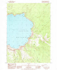
Crater Lake East, Oregon, USGS topographic map dated 1985.
Includes geographic coordinates (latitude and longitude). This topographic map is suitable for hiking, camping, and exploring, or framing it as a wall map.
Printed on-demand using high resolution imagery, on heavy weight and acid free paper, or alternatively on a variety of synthetic materials.
Topos available on paper, Waterproof, Poly, or Tyvek. Usually shipping rolled, unless combined with other folded maps in one order.
- Product Number: USGS-5417650
- Free digital map download (high-resolution, GeoPDF): Crater Lake East, Oregon (file size: 14 MB)
- Map Size: please refer to the dimensions of the GeoPDF map above
- Weight (paper map): ca. 55 grams
- Map Type: POD USGS Topographic Map
- Map Series: HTMC
- Map Verison: Historical
- Cell ID: 10606
- Scan ID: 279502
- Imprint Year: 1985
- Woodland Tint: Yes
- Aerial Photo Year: 1982
- Edit Year: 1985
- Field Check Year: 1982
- Datum: NAD27
- Map Projection: Lambert Conformal Conic
- Provisional map: Yes
- Map published by United States Geological Survey
- Map Language: English
- Scanner Resolution: 600 dpi
- Map Cell Name: Crater Lake East
- Grid size: 7.5 X 7.5 Minute
- Date on map: 1985
- Map Scale: 1:24000
- Geographical region: Oregon, United States
Neighboring Maps:
All neighboring USGS topo maps are available for sale online at a variety of scales.
Spatial coverage:
Topo map Crater Lake East, Oregon, covers the geographical area associated the following places:
- Sun Notch - Crater Lake - Grotto Cove - Anderson Bluffs - Sentinel Rock - Cleetwood Cove - Mount Mazama - Cloudcap Bay - Chaski Bay - Vidae Ridge - Base of Mount Mazama - Mount Scott Trail - Dyar Rock - Danger Bay - Grouse Hill - Skell Head - Rugged Crest Palisades - Garfield Peak - Pumice Point - Eagle Point - Palisades - Pumice Castle - Dutton Cliff - Palisade Point - Lost Creek Spring - Rugged Crest - Victor View - Sun Notch Trail - Garfield Peak Trail - Dutton Ridge - Mount Scott - Eagle Crags - Kerr Valley - Cloudcap - Bear Creek Trail - Roundtop - Kerr Notch - Scott Bluffs - Steel Bay - Sun Meadows - Redcloud Cliff - Phantom Ship - Anderson Spring - Vidae Cliff - Lost Creek Ranger Station - Mazama Rock - Cascade Spring - Lost Creek Recreation Site - Mount Scott Lookout - Castle Rock - Wineglass - Applegate Peak
- Map Area ID: AREA4342.875-122.125-122
- Northwest corner Lat/Long code: USGSNW43-122.125
- Northeast corner Lat/Long code: USGSNE43-122
- Southwest corner Lat/Long code: USGSSW42.875-122.125
- Southeast corner Lat/Long code: USGSSE42.875-122
- Northern map edge Latitude: 43
- Southern map edge Latitude: 42.875
- Western map edge Longitude: -122.125
- Eastern map edge Longitude: -122


