
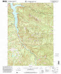
~ Cougar Reservoir OR topo map, 1:24000 scale, 7.5 X 7.5 Minute, Historical, 1997, updated 2001
Cougar Reservoir, Oregon, USGS topographic map dated 1997.
Includes geographic coordinates (latitude and longitude). This topographic map is suitable for hiking, camping, and exploring, or framing it as a wall map.
Printed on-demand using high resolution imagery, on heavy weight and acid free paper, or alternatively on a variety of synthetic materials.
Topos available on paper, Waterproof, Poly, or Tyvek. Usually shipping rolled, unless combined with other folded maps in one order.
- Product Number: USGS-5417558
- Free digital map download (high-resolution, GeoPDF): Cougar Reservoir, Oregon (file size: 20 MB)
- Map Size: please refer to the dimensions of the GeoPDF map above
- Weight (paper map): ca. 55 grams
- Map Type: POD USGS Topographic Map
- Map Series: HTMC
- Map Verison: Historical
- Cell ID: 10337
- Scan ID: 279456
- Imprint Year: 2001
- Woodland Tint: Yes
- Aerial Photo Year: 1995
- Datum: NAD27
- Map Projection: Lambert Conformal Conic
- Map published by United States Geological Survey
- Map published by United States Forest Service
- Map Language: English
- Scanner Resolution: 600 dpi
- Map Cell Name: Cougar Reservoir
- Grid size: 7.5 X 7.5 Minute
- Date on map: 1997
- Map Scale: 1:24000
- Geographical region: Oregon, United States
Neighboring Maps:
All neighboring USGS topo maps are available for sale online at a variety of scales.
Spatial coverage:
Topo map Cougar Reservoir, Oregon, covers the geographical area associated the following places:
- Horn Creek - McKenzie River Division - Cougar Crossing Recreation Site - Balm Creek - Hardy Creek - Terwilliger Hot Spring - Tipsoo Trail - Slide Creek Boat Ramp - Tipsoo Butte - Cougar Reservoir - Smith Creek - Rebel Creek - Willamette National Forest - East Fork South Fork McKenzie River - Buoy Creek - Boone Creek - Slide Creek - Hard Rock Recreation Site - Tipsoo Creek - Lowder Mountain - Hidden Lake - Sawtooth Ridge - Yankee Creek - Slide Creek Recreation Site - Terwilliger Hot Springs Recreation Site - Basalt Creek - Red Diamond Recreation Site - Walker Creek - Rider Creek - French Pete Creek - Ridge Creek - Cougar Cossing - Hardy Ridge - Annie Creek - Penny Creek - Trail Creek - Sunnyside Recreation Site - East Fork/Echo Recreation Site - Echo / East Fork Boat Ramp - French Pete Recreation Site - Yankee Mountain - McLennan Mountain
- Map Area ID: AREA44.12544-122.25-122.125
- Northwest corner Lat/Long code: USGSNW44.125-122.25
- Northeast corner Lat/Long code: USGSNE44.125-122.125
- Southwest corner Lat/Long code: USGSSW44-122.25
- Southeast corner Lat/Long code: USGSSE44-122.125
- Northern map edge Latitude: 44.125
- Southern map edge Latitude: 44
- Western map edge Longitude: -122.25
- Eastern map edge Longitude: -122.125


