
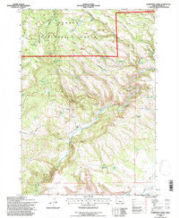
~ Committee Creek OR topo map, 1:24000 scale, 7.5 X 7.5 Minute, Historical, 1992, updated 1997
Committee Creek, Oregon, USGS topographic map dated 1992.
Includes geographic coordinates (latitude and longitude). This topographic map is suitable for hiking, camping, and exploring, or framing it as a wall map.
Printed on-demand using high resolution imagery, on heavy weight and acid free paper, or alternatively on a variety of synthetic materials.
Topos available on paper, Waterproof, Poly, or Tyvek. Usually shipping rolled, unless combined with other folded maps in one order.
- Product Number: USGS-5417484
- Free digital map download (high-resolution, GeoPDF): Committee Creek, Oregon (file size: 16 MB)
- Map Size: please refer to the dimensions of the GeoPDF map above
- Weight (paper map): ca. 55 grams
- Map Type: POD USGS Topographic Map
- Map Series: HTMC
- Map Verison: Historical
- Cell ID: 9768
- Scan ID: 279418
- Imprint Year: 1997
- Woodland Tint: Yes
- Aerial Photo Year: 1999
- Datum: NAD27
- Map Projection: Lambert Conformal Conic
- Map published by United States Geological Survey
- Map published by United States Forest Service
- Map Language: English
- Scanner Resolution: 600 dpi
- Map Cell Name: Committee Creek
- Grid size: 7.5 X 7.5 Minute
- Date on map: 1992
- Map Scale: 1:24000
- Geographical region: Oregon, United States
Neighboring Maps:
All neighboring USGS topo maps are available for sale online at a variety of scales.
Spatial coverage:
Topo map Committee Creek, Oregon, covers the geographical area associated the following places:
- Rough Spring - Hail Creek - Battle Point - Mudhole Reservoir - Committee Spring - Little Juniper Reservoir - Watson Creek - Rough Canyon Creek - Mud Spring - Rimrock Reservoir - Swamp Creek - Veason Spring - Teater Spring - Long Ridge - Basin Spring - Hole-in-the-Ground Reservoir - Old Faithful Reservoir - Lone Pine Spring - Teaters Ranch - Rough Canyon - Cherry Spring - Fly Reservoir - Booton Spring - Gate One Reservoir - Boundary Reservoir - Juniper Spring - Bracket Canyon - Cabin Spring - Lutsey Reservoir - Oscar Canyon - Cabin Butte - Juniper Canyon Reservoir - Mud Spring Canyon - Lower Falls - Juniper Canyon - Telephone Springs - Federal Spring - Funeral Ridge - Boundary Reservoir - Partnership Reservoir - Tohatin Reservoir - Committee Creek
- Map Area ID: AREA44.2544.125-120.25-120.125
- Northwest corner Lat/Long code: USGSNW44.25-120.25
- Northeast corner Lat/Long code: USGSNE44.25-120.125
- Southwest corner Lat/Long code: USGSSW44.125-120.25
- Southeast corner Lat/Long code: USGSSE44.125-120.125
- Northern map edge Latitude: 44.25
- Southern map edge Latitude: 44.125
- Western map edge Longitude: -120.25
- Eastern map edge Longitude: -120.125


