
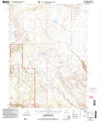
~ Collins Rim OR topo map, 1:24000 scale, 7.5 X 7.5 Minute, Historical, 2004, updated 2007
Collins Rim, Oregon, USGS topographic map dated 2004.
Includes geographic coordinates (latitude and longitude). This topographic map is suitable for hiking, camping, and exploring, or framing it as a wall map.
Printed on-demand using high resolution imagery, on heavy weight and acid free paper, or alternatively on a variety of synthetic materials.
Topos available on paper, Waterproof, Poly, or Tyvek. Usually shipping rolled, unless combined with other folded maps in one order.
- Product Number: USGS-5417468
- Free digital map download (high-resolution, GeoPDF): Collins Rim, Oregon (file size: 11 MB)
- Map Size: please refer to the dimensions of the GeoPDF map above
- Weight (paper map): ca. 55 grams
- Map Type: POD USGS Topographic Map
- Map Series: HTMC
- Map Verison: Historical
- Cell ID: 9608
- Scan ID: 279407
- Imprint Year: 2007
- Woodland Tint: Yes
- Aerial Photo Year: 2001
- Datum: NAD27
- Map Projection: Universal Transverse Mercator
- Map published by United States Geological Survey
- Map published by United States Forest Service
- Map Language: English
- Scanner Resolution: 600 dpi
- Map Cell Name: Collins Rim
- Grid size: 7.5 X 7.5 Minute
- Date on map: 2004
- Map Scale: 1:24000
- Geographical region: Oregon, United States
Neighboring Maps:
All neighboring USGS topo maps are available for sale online at a variety of scales.
Spatial coverage:
Topo map Collins Rim, Oregon, covers the geographical area associated the following places:
- O'Keefe Reservoir Number Four - Long Canyon - Lane Waterhole Number Twelve - Collins Rim - O'Keefe Reservoir - Lane Waterhole Number Eleven - Round Mountain Spring - Dismal Spring - Pope Spring - Barley Camp Creek - Collins Cabin - O'Keefe Reservoir Number Six - Mate Cabin - Rattlesnake Spring - Moss Springs - Round Mountain - Barley Camp - Rim Rock Spring - Juniper Lake - Lane Reservoir Number Four - Haw Cabin - Frakes Cabin
- Map Area ID: AREA42.12542-120.125-120
- Northwest corner Lat/Long code: USGSNW42.125-120.125
- Northeast corner Lat/Long code: USGSNE42.125-120
- Southwest corner Lat/Long code: USGSSW42-120.125
- Southeast corner Lat/Long code: USGSSE42-120
- Northern map edge Latitude: 42.125
- Southern map edge Latitude: 42
- Western map edge Longitude: -120.125
- Eastern map edge Longitude: -120


