
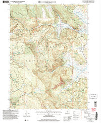
~ Coleman Point OR topo map, 1:24000 scale, 7.5 X 7.5 Minute, Historical, 2004, updated 2007
Coleman Point, Oregon, USGS topographic map dated 2004.
Includes geographic coordinates (latitude and longitude). This topographic map is suitable for hiking, camping, and exploring, or framing it as a wall map.
Printed on-demand using high resolution imagery, on heavy weight and acid free paper, or alternatively on a variety of synthetic materials.
Topos available on paper, Waterproof, Poly, or Tyvek. Usually shipping rolled, unless combined with other folded maps in one order.
- Product Number: USGS-5417454
- Free digital map download (high-resolution, GeoPDF): Coleman Point, Oregon (file size: 17 MB)
- Map Size: please refer to the dimensions of the GeoPDF map above
- Weight (paper map): ca. 55 grams
- Map Type: POD USGS Topographic Map
- Map Series: HTMC
- Map Verison: Historical
- Cell ID: 9552
- Scan ID: 279399
- Imprint Year: 2007
- Woodland Tint: Yes
- Aerial Photo Year: 2001
- Datum: NAD83
- Map Projection: Universal Transverse Mercator
- Map published by United States Geological Survey
- Map published by United States Forest Service
- Map Language: English
- Scanner Resolution: 600 dpi
- Map Cell Name: Coleman Point
- Grid size: 7.5 X 7.5 Minute
- Date on map: 2004
- Map Scale: 1:24000
- Geographical region: Oregon, United States
Neighboring Maps:
All neighboring USGS topo maps are available for sale online at a variety of scales.
Spatial coverage:
Topo map Coleman Point, Oregon, covers the geographical area associated the following places:
- Picture Flat - Eagle Spring - Grasshopper Spring - Bean Spring - Blonde Spring - Dairy Creek Guard Station - Teepee Creek - Dead Horse Creek - Coleman Point - South Flat - Clear Spring - Dead Horse Recreation Site - Deer Creek - Brush Spring - Dairy Point - North Fork Augur Creek - Cliff Spring - Round Spring - Augur Creek - Morgan Spring - Barrel Spring - Dairy Creek Campground (historical) - Colt Spring - Lantern Flat - Shepard Camp - Snag Spring - Anderson Ranch - Spring Creek - Dairy Point Recreation Site - Lantern Flat Guard Station - Drum Hill - Morgan Creek - Coleman Spring - Grasshopper Flat - Road Spring - Murphy Ranch - Happy Camp Recreation Site - Clear Spring Recreation Site
- Map Area ID: AREA42.542.375-120.75-120.625
- Northwest corner Lat/Long code: USGSNW42.5-120.75
- Northeast corner Lat/Long code: USGSNE42.5-120.625
- Southwest corner Lat/Long code: USGSSW42.375-120.75
- Southeast corner Lat/Long code: USGSSE42.375-120.625
- Northern map edge Latitude: 42.5
- Southern map edge Latitude: 42.375
- Western map edge Longitude: -120.75
- Eastern map edge Longitude: -120.625


