
~ Chief Joseph Mtn OR topo map, 1:24000 scale, 7.5 X 7.5 Minute, Historical, 1990, updated 1990
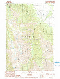
Chief Joseph Mtn, Oregon, USGS topographic map dated 1990.
Includes geographic coordinates (latitude and longitude). This topographic map is suitable for hiking, camping, and exploring, or framing it as a wall map.
Printed on-demand using high resolution imagery, on heavy weight and acid free paper, or alternatively on a variety of synthetic materials.
Topos available on paper, Waterproof, Poly, or Tyvek. Usually shipping rolled, unless combined with other folded maps in one order.
- Product Number: USGS-5417324
- Free digital map download (high-resolution, GeoPDF): Chief Joseph Mtn, Oregon (file size: 15 MB)
- Map Size: please refer to the dimensions of the GeoPDF map above
- Weight (paper map): ca. 55 grams
- Map Type: POD USGS Topographic Map
- Map Series: HTMC
- Map Verison: Historical
- Cell ID: 8505
- Scan ID: 279334
- Imprint Year: 1990
- Woodland Tint: Yes
- Visual Version Number: 3
- Aerial Photo Year: 1981
- Edit Year: 1990
- Field Check Year: 1987
- Datum: NAD27
- Map Projection: Lambert Conformal Conic
- Provisional map: Yes
- Map published by United States Geological Survey
- Map Language: English
- Scanner Resolution: 600 dpi
- Map Cell Name: Chief Joseph Mountain
- Grid size: 7.5 X 7.5 Minute
- Date on map: 1990
- Map Scale: 1:24000
- Geographical region: Oregon, United States
Neighboring Maps:
All neighboring USGS topo maps are available for sale online at a variety of scales.
Spatial coverage:
Topo map Chief Joseph Mtn, Oregon, covers the geographical area associated the following places:
- Sawtooth Peak - Twin Creek - Falls Creek - Ruby Peak - Chief Joseph Mountain - Billy Jones Creek - Joseph Cemetery - Newby Creek - Hurricane Divide - Echo Lake - Mill Creek - Legore Mine - Hurricane Creek Recreation Site - Deadman Lake - Little Granite Creek - Miners Basin - Consolidated Ditch - Granite Meadow - Joseph Mountain Mines - Joseph State Airport - Twin Peaks - Francis Lake - Slick Rock Creek - Hurricane Rapids - Dunn Creek - Spring Creek - Point Joseph - Billy Jones Lake - Hurwal Divide - Granite Creek - Hurricane Grange - Hurricane Point - Murray Saddle - Thorp Creek - Deadman Creek - Legore Lake - Silver Grange Ditch - Falls Creek Forest Camp - Traverse Ridge - Hurricane Ditch - Hurricane Creek Trailhead
- Map Area ID: AREA45.37545.25-117.375-117.25
- Northwest corner Lat/Long code: USGSNW45.375-117.375
- Northeast corner Lat/Long code: USGSNE45.375-117.25
- Southwest corner Lat/Long code: USGSSW45.25-117.375
- Southeast corner Lat/Long code: USGSSE45.25-117.25
- Northern map edge Latitude: 45.375
- Southern map edge Latitude: 45.25
- Western map edge Longitude: -117.375
- Eastern map edge Longitude: -117.25


