
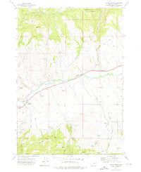
~ Castle Creek OR topo map, 1:24000 scale, 7.5 X 7.5 Minute, Historical, 1972, updated 1976
Castle Creek, Oregon, USGS topographic map dated 1972.
Includes geographic coordinates (latitude and longitude). This topographic map is suitable for hiking, camping, and exploring, or framing it as a wall map.
Printed on-demand using high resolution imagery, on heavy weight and acid free paper, or alternatively on a variety of synthetic materials.
Topos available on paper, Waterproof, Poly, or Tyvek. Usually shipping rolled, unless combined with other folded maps in one order.
- Product Number: USGS-5417240
- Free digital map download (high-resolution, GeoPDF): Castle Creek, Oregon (file size: 10 MB)
- Map Size: please refer to the dimensions of the GeoPDF map above
- Weight (paper map): ca. 55 grams
- Map Type: POD USGS Topographic Map
- Map Series: HTMC
- Map Verison: Historical
- Cell ID: 7574
- Scan ID: 279288
- Imprint Year: 1976
- Woodland Tint: Yes
- Aerial Photo Year: 1971
- Field Check Year: 1972
- Datum: NAD27
- Map Projection: Lambert Conformal Conic
- Map published by United States Geological Survey
- Map Language: English
- Scanner Resolution: 600 dpi
- Map Cell Name: Castle Creek
- Grid size: 7.5 X 7.5 Minute
- Date on map: 1972
- Map Scale: 1:24000
- Geographical region: Oregon, United States
Neighboring Maps:
All neighboring USGS topo maps are available for sale online at a variety of scales.
Spatial coverage:
Topo map Castle Creek, Oregon, covers the geographical area associated the following places:
- Jones Spring - McKinney Creek - Johnson Ranch - Hardy Spring - Fisk Creek - Dissel Creek - Prairie City Wastewater Treatment Lagoons - Red Hill - Little Indian Creek - Bear Creek - Grub Creek - Dead Horse Spring - West Fork Little Indian Creek - Indian Creek - Bear Gulch - Holiday Ranch - H Ricco Ranch - H Coombs Ranch - Oliver Rock - Kuhl Ranch - Pine Creek - Deep Gulch - Hall Hill - Prairie Diggings - Castle Creek - Holliday Ranch - John Day River Dam - Butch Foster Saddle - Big Gulch - Howard Ranch - Gwyn Creek - Oliver Ranch - Cottonwood Spring - West Fork Pine Creek - Indian Creek School (historical) - Dean Creek - Birch Spring - Clark Ranch - Johnson Springs
- Map Area ID: AREA44.544.375-118.875-118.75
- Northwest corner Lat/Long code: USGSNW44.5-118.875
- Northeast corner Lat/Long code: USGSNE44.5-118.75
- Southwest corner Lat/Long code: USGSSW44.375-118.875
- Southeast corner Lat/Long code: USGSSE44.375-118.75
- Northern map edge Latitude: 44.5
- Southern map edge Latitude: 44.375
- Western map edge Longitude: -118.875
- Eastern map edge Longitude: -118.75


