
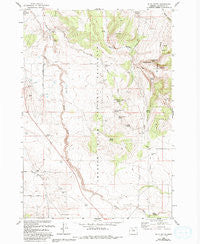
~ Buck Butte OR topo map, 1:24000 scale, 7.5 X 7.5 Minute, Historical, 1985, updated 1994
Buck Butte, Oregon, USGS topographic map dated 1985.
Includes geographic coordinates (latitude and longitude). This topographic map is suitable for hiking, camping, and exploring, or framing it as a wall map.
Printed on-demand using high resolution imagery, on heavy weight and acid free paper, or alternatively on a variety of synthetic materials.
Topos available on paper, Waterproof, Poly, or Tyvek. Usually shipping rolled, unless combined with other folded maps in one order.
- Product Number: USGS-5417012
- Free digital map download (high-resolution, GeoPDF): Buck Butte, Oregon (file size: 11 MB)
- Map Size: please refer to the dimensions of the GeoPDF map above
- Weight (paper map): ca. 55 grams
- Map Type: POD USGS Topographic Map
- Map Series: HTMC
- Map Verison: Historical
- Cell ID: 5864
- Scan ID: 279170
- Imprint Year: 1994
- Woodland Tint: Yes
- Aerial Photo Year: 1982
- Edit Year: 1985
- Field Check Year: 1963
- Datum: NAD27
- Map Projection: Polyconic
- Map published by United States Geological Survey
- Map published by United States Forest Service
- Map Language: English
- Scanner Resolution: 600 dpi
- Map Cell Name: Buck Butte
- Grid size: 7.5 X 7.5 Minute
- Date on map: 1985
- Map Scale: 1:24000
- Geographical region: Oregon, United States
Neighboring Maps:
All neighboring USGS topo maps are available for sale online at a variety of scales.
Spatial coverage:
Topo map Buck Butte, Oregon, covers the geographical area associated the following places:
- Boyce Corral - Cap Healy Well - Hardwick Well - Bennett Well - Reuter Well - Parkey Springs - Bishop Spring - Gray Butte Creek - Reichen Well - Boyce Pond Well - C W A Well - Larson Spring - Juniper Spring - Canyon Spring - North Combs Spring - Dayton-Grant Well - Suicide Well - Willow Creek Corral - Upper Bennett Spring - Blanchard Well - Cottonwood Spring - Degner Well - Crooked River National Grassland - McMeen Spring - Lower Bennett Spring - McMeen Creek - South Waste Water Treatment Facility - Buck Butte - Devine Well - Wagonblast Canyon
- Map Area ID: AREA44.62544.5-121.125-121
- Northwest corner Lat/Long code: USGSNW44.625-121.125
- Northeast corner Lat/Long code: USGSNE44.625-121
- Southwest corner Lat/Long code: USGSSW44.5-121.125
- Southeast corner Lat/Long code: USGSSE44.5-121
- Northern map edge Latitude: 44.625
- Southern map edge Latitude: 44.5
- Western map edge Longitude: -121.125
- Eastern map edge Longitude: -121


