
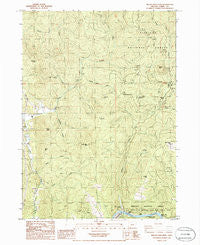
~ Brushy Bald Mountain OR topo map, 1:24000 scale, 7.5 X 7.5 Minute, Historical, 1986, updated 1986
Brushy Bald Mountain, Oregon, USGS topographic map dated 1986.
Includes geographic coordinates (latitude and longitude). This topographic map is suitable for hiking, camping, and exploring, or framing it as a wall map.
Printed on-demand using high resolution imagery, on heavy weight and acid free paper, or alternatively on a variety of synthetic materials.
Topos available on paper, Waterproof, Poly, or Tyvek. Usually shipping rolled, unless combined with other folded maps in one order.
- Product Number: USGS-5416996
- Free digital map download (high-resolution, GeoPDF): Brushy Bald Mountain, Oregon (file size: 14 MB)
- Map Size: please refer to the dimensions of the GeoPDF map above
- Weight (paper map): ca. 55 grams
- Map Type: POD USGS Topographic Map
- Map Series: HTMC
- Map Verison: Historical
- Cell ID: 5821
- Scan ID: 279162
- Imprint Year: 1986
- Woodland Tint: Yes
- Aerial Photo Year: 1982
- Edit Year: 1986
- Field Check Year: 1982
- Datum: NAD27
- Map Projection: Lambert Conformal Conic
- Map published by United States Geological Survey
- Map Language: English
- Scanner Resolution: 600 dpi
- Map Cell Name: Brushy Bald Mountain
- Grid size: 7.5 X 7.5 Minute
- Date on map: 1986
- Map Scale: 1:24000
- Geographical region: Oregon, United States
Neighboring Maps:
All neighboring USGS topo maps are available for sale online at a variety of scales.
Spatial coverage:
Topo map Brushy Bald Mountain, Oregon, covers the geographical area associated the following places:
- Lobster Creek - Lost Valley Creek - Lobster Riffle - Ulmer Mountain - First Prairie Mountain - Cedar Point - Fall Creek - William Miller Riffle - Crew Canyon - Brushy Bald Mountain - Boulder Creek - Lobster Bar - Lobster Creek Bridge - Scow Riffle - Cedar Creek - Colebrook Butte - Sherman Ranch - Lobster Creek Boat Ramp - Lobster Creek Recreation Site - Gillman Creek - Deadline Creek - Coffee Butte - Jennings Riffle - Squaw Valley - Rock Creek - Miller Creek - Crooked Bridge Creek - Lobster Hill - Euchre Creek Pond - Bark Shanty Prairie
- Map Area ID: AREA42.62542.5-124.375-124.25
- Northwest corner Lat/Long code: USGSNW42.625-124.375
- Northeast corner Lat/Long code: USGSNE42.625-124.25
- Southwest corner Lat/Long code: USGSSW42.5-124.375
- Southeast corner Lat/Long code: USGSSE42.5-124.25
- Northern map edge Latitude: 42.625
- Southern map edge Latitude: 42.5
- Western map edge Longitude: -124.375
- Eastern map edge Longitude: -124.25


