
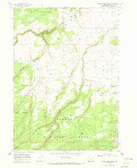
~ Bridge Creek Draw OR topo map, 1:24000 scale, 7.5 X 7.5 Minute, Historical, 1968, updated 1972
Bridge Creek Draw, Oregon, USGS topographic map dated 1968.
Includes geographic coordinates (latitude and longitude). This topographic map is suitable for hiking, camping, and exploring, or framing it as a wall map.
Printed on-demand using high resolution imagery, on heavy weight and acid free paper, or alternatively on a variety of synthetic materials.
Topos available on paper, Waterproof, Poly, or Tyvek. Usually shipping rolled, unless combined with other folded maps in one order.
- Product Number: USGS-5416944
- Free digital map download (high-resolution, GeoPDF): Bridge Creek Draw, Oregon (file size: 9 MB)
- Map Size: please refer to the dimensions of the GeoPDF map above
- Weight (paper map): ca. 55 grams
- Map Type: POD USGS Topographic Map
- Map Series: HTMC
- Map Verison: Historical
- Cell ID: 5404
- Scan ID: 279136
- Imprint Year: 1972
- Woodland Tint: Yes
- Visual Version Number: 2
- Aerial Photo Year: 1967
- Field Check Year: 1968
- Datum: NAD27
- Map Projection: Polyconic
- Map published by United States Geological Survey
- Map Language: English
- Scanner Resolution: 600 dpi
- Map Cell Name: Bridge Creek Draw
- Grid size: 7.5 X 7.5 Minute
- Date on map: 1968
- Map Scale: 1:24000
- Geographical region: Oregon, United States
Neighboring Maps:
All neighboring USGS topo maps are available for sale online at a variety of scales.
Spatial coverage:
Topo map Bridge Creek Draw, Oregon, covers the geographical area associated the following places:
- Silver Creek Marsh Recreation Site - Bridge Creek Draw - Brewer Ranch - D Emery Ranch - Freeman Spring - Howard Ranch - Bridge Creek Waterhole - Freeman Ranch - Silver Creek Marsh - Porterville Post Office (historical) - Chase Spring - McBroom Spring - Thirteenmile Spring - Lundy Spring - Lower Buck Creek Recreation Site - Staked Waterhole - Timothy Creek - Mud Spring - Ted Reservoir - South Spring Reservoir - Cliff Spring - Willow Spring - McBroom Administrative Study Plot - Cashow Springs - Cashow Flat - McBroom Ranch - Bear Creek - Pitcher Ranch - South Spring - Basalt Reservoir - Buck Creek Crossing
- Map Area ID: AREA43.12543-121.25-121.125
- Northwest corner Lat/Long code: USGSNW43.125-121.25
- Northeast corner Lat/Long code: USGSNE43.125-121.125
- Southwest corner Lat/Long code: USGSSW43-121.25
- Southeast corner Lat/Long code: USGSSE43-121.125
- Northern map edge Latitude: 43.125
- Southern map edge Latitude: 43
- Western map edge Longitude: -121.25
- Eastern map edge Longitude: -121.125


