
~ Boulder Butte OR topo map, 1:24000 scale, 7.5 X 7.5 Minute, Historical, 1988, updated 1988
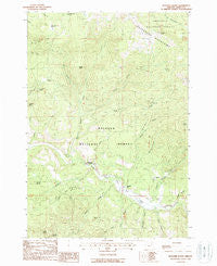
Boulder Butte, Oregon, USGS topographic map dated 1988.
Includes geographic coordinates (latitude and longitude). This topographic map is suitable for hiking, camping, and exploring, or framing it as a wall map.
Printed on-demand using high resolution imagery, on heavy weight and acid free paper, or alternatively on a variety of synthetic materials.
Topos available on paper, Waterproof, Poly, or Tyvek. Usually shipping rolled, unless combined with other folded maps in one order.
- Product Number: USGS-5416874
- Free digital map download (high-resolution, GeoPDF): Boulder Butte, Oregon (file size: 14 MB)
- Map Size: please refer to the dimensions of the GeoPDF map above
- Weight (paper map): ca. 55 grams
- Map Type: POD USGS Topographic Map
- Map Series: HTMC
- Map Verison: Historical
- Cell ID: 4967
- Scan ID: 279099
- Imprint Year: 1988
- Woodland Tint: Yes
- Aerial Photo Year: 1982
- Edit Year: 1988
- Field Check Year: 1985
- Datum: NAD27
- Map Projection: Lambert Conformal Conic
- Map published by United States Geological Survey
- Map Language: English
- Scanner Resolution: 600 dpi
- Map Cell Name: Boulder Butte
- Grid size: 7.5 X 7.5 Minute
- Date on map: 1988
- Map Scale: 1:24000
- Geographical region: Oregon, United States
Neighboring Maps:
All neighboring USGS topo maps are available for sale online at a variety of scales.
Spatial coverage:
Topo map Boulder Butte, Oregon, covers the geographical area associated the following places:
- Badger Creek - Sunshine Springs - West Fork Ruby Creek - Sunshine Guard Station - McCalpine Meadow - Cougar Ridge - Coyote Creek - Crockett Spring - Stalter Mine - Tincup Creek - Coyote Meadow - China Diggings - Wray Mine - Sunshine Creek - Granite Boulder Creek - Windlass Creek - Haystack Spring - Reed Mine - Ragged Creek - Coyote Bluff - Grassy Spring - Ruby Creek - Boulder Butte - Bear Paw Meadow - Stithum Mine - Big Boulder Creek - Squatter Flat - Middle Fork Sunshine Creek - Butte Creek - Plute Spring - Vinegar Hill-Indian Rock Scenic Area - Corner Creek - Riverside Gulch - East Fork Sunshine Creek - Corey Gulch - Big Boulder Trail - Beaver Creek - Myrtle Creek - Dry Creek - East Fork Coyote Creek - Wray Creek - Myrtle Butte
- Map Area ID: AREA44.7544.625-118.75-118.625
- Northwest corner Lat/Long code: USGSNW44.75-118.75
- Northeast corner Lat/Long code: USGSNE44.75-118.625
- Southwest corner Lat/Long code: USGSSW44.625-118.75
- Southeast corner Lat/Long code: USGSSE44.625-118.625
- Northern map edge Latitude: 44.75
- Southern map edge Latitude: 44.625
- Western map edge Longitude: -118.75
- Eastern map edge Longitude: -118.625


