
~ Bologna Basin OR topo map, 1:24000 scale, 7.5 X 7.5 Minute, Historical, 1990, updated 1990
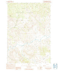
Bologna Basin, Oregon, USGS topographic map dated 1990.
Includes geographic coordinates (latitude and longitude). This topographic map is suitable for hiking, camping, and exploring, or framing it as a wall map.
Printed on-demand using high resolution imagery, on heavy weight and acid free paper, or alternatively on a variety of synthetic materials.
Topos available on paper, Waterproof, Poly, or Tyvek. Usually shipping rolled, unless combined with other folded maps in one order.
- Product Number: USGS-5416854
- Free digital map download (high-resolution, GeoPDF): Bologna Basin, Oregon (file size: 12 MB)
- Map Size: please refer to the dimensions of the GeoPDF map above
- Weight (paper map): ca. 55 grams
- Map Type: POD USGS Topographic Map
- Map Series: HTMC
- Map Verison: Historical
- Cell ID: 72285
- Scan ID: 279087
- Imprint Year: 1990
- Woodland Tint: Yes
- Aerial Photo Year: 1984
- Edit Year: 1990
- Field Check Year: 1987
- Datum: NAD27
- Map Projection: Lambert Conformal Conic
- Provisional map: Yes
- Map published by United States Geological Survey
- Map Language: English
- Scanner Resolution: 600 dpi
- Map Cell Name: Bologna Basin
- Grid size: 7.5 X 7.5 Minute
- Date on map: 1990
- Map Scale: 1:24000
- Geographical region: Oregon, United States
Neighboring Maps:
All neighboring USGS topo maps are available for sale online at a variety of scales.
Spatial coverage:
Topo map Bologna Basin, Oregon, covers the geographical area associated the following places:
- West Fork Cochran Creek - Alkali Flats - Rail Canyon - Thorn Spring - Rudio Creek - Thorn Spring Butte - Cochran Creek - Bologna Basin - Tommy Cork Spring - Putnam Spring - Negro Knob Trail (historical) - Bologna Spring - Ant Hill - Portuguese Canyon - Rains Canyon - Negro Knob - Gilmore Creek - Neal Dam - Waller Reservoir Number Four - Birch Creek - Dry Creek - Wagon Road Gulch - Cupper Canyon - Big Bend
- Map Area ID: AREA44.87544.75-119.625-119.5
- Northwest corner Lat/Long code: USGSNW44.875-119.625
- Northeast corner Lat/Long code: USGSNE44.875-119.5
- Southwest corner Lat/Long code: USGSSW44.75-119.625
- Southeast corner Lat/Long code: USGSSE44.75-119.5
- Northern map edge Latitude: 44.875
- Southern map edge Latitude: 44.75
- Western map edge Longitude: -119.625
- Eastern map edge Longitude: -119.5


