
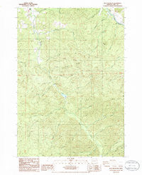
~ Blue Mountain OR topo map, 1:24000 scale, 7.5 X 7.5 Minute, Historical, 1986, updated 1986
Blue Mountain, Oregon, USGS topographic map dated 1986.
Includes geographic coordinates (latitude and longitude). This topographic map is suitable for hiking, camping, and exploring, or framing it as a wall map.
Printed on-demand using high resolution imagery, on heavy weight and acid free paper, or alternatively on a variety of synthetic materials.
Topos available on paper, Waterproof, Poly, or Tyvek. Usually shipping rolled, unless combined with other folded maps in one order.
- Product Number: USGS-5416826
- Free digital map download (high-resolution, GeoPDF): Blue Mountain, Oregon (file size: 15 MB)
- Map Size: please refer to the dimensions of the GeoPDF map above
- Weight (paper map): ca. 55 grams
- Map Type: POD USGS Topographic Map
- Map Series: HTMC
- Map Verison: Historical
- Cell ID: 4533
- Scan ID: 279073
- Imprint Year: 1986
- Woodland Tint: Yes
- Aerial Photo Year: 1982
- Edit Year: 1986
- Field Check Year: 1984
- Datum: NAD27
- Map Projection: Lambert Conformal Conic
- Provisional map: Yes
- Map published by United States Geological Survey
- Map Language: English
- Scanner Resolution: 600 dpi
- Map Cell Name: Blue Mountain
- Grid size: 7.5 X 7.5 Minute
- Date on map: 1986
- Map Scale: 1:24000
- Geographical region: Oregon, United States
Neighboring Maps:
All neighboring USGS topo maps are available for sale online at a variety of scales.
Spatial coverage:
Topo map Blue Mountain, Oregon, covers the geographical area associated the following places:
- Row River Post Office (historical) - Fall Creek - Perkins Creek - Clearing Creek - Booth-Kelly Lumber Company Log Pond - Palmer Creek - Cow Creek - Lewis Creek - Simpson Creek - Dorena Bridge - Table Rock Creek - Vaughn County Park - Kennedy Creek - Kizer Creek - Booth-Kelly Lumber Company Log Pond Dike - Dorena School - Broumbaugh Cemetery - Blue Mountain - Windfall Adverse - Blue Rock - Row River (historical) - Cedar Creek - King Creek - South Fork Rock Creek - North Fork Stell Creek - Rock Creek - Blue Creek - Allen Creek - Stewart (historical) - North Fork Rock Creek - Smith Creek - Blue Mountain County Park - Blue Mountain Charter School (historical) - Big Rock - Abrams - Round Mountain - Pitcher Creek - Stell Creek - Anderson Creek - Short Creek
- Map Area ID: AREA43.7543.625-123-122.875
- Northwest corner Lat/Long code: USGSNW43.75-123
- Northeast corner Lat/Long code: USGSNE43.75-122.875
- Southwest corner Lat/Long code: USGSSW43.625-123
- Southeast corner Lat/Long code: USGSSE43.625-122.875
- Northern map edge Latitude: 43.75
- Southern map edge Latitude: 43.625
- Western map edge Longitude: -123
- Eastern map edge Longitude: -122.875


