
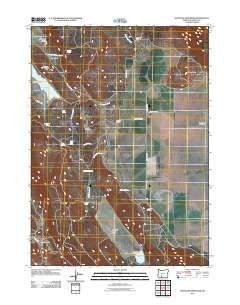
~ Whiteline Reservoir OR topo map, 1:24000 scale, 7.5 X 7.5 Minute, Historical, 2011
Whiteline Reservoir, Oregon, USGS topographic map dated 2011.
Includes geographic coordinates (latitude and longitude). This topographic map is suitable for hiking, camping, and exploring, or framing it as a wall map.
Printed on-demand using high resolution imagery, on heavy weight and acid free paper, or alternatively on a variety of synthetic materials.
Topos available on paper, Waterproof, Poly, or Tyvek. Usually shipping rolled, unless combined with other folded maps in one order.
- Product Number: USGS-5416772
- Free digital map download (high-resolution, GeoPDF): Whiteline Reservoir, Oregon (file size: 21 MB)
- Map Size: please refer to the dimensions of the GeoPDF map above
- Weight (paper map): ca. 55 grams
- Map Type: POD USGS Topographic Map
- Map Series: US Topo
- Map Verison: Historical
- Cell ID: 48822
- Datum: North American Datum of 1983
- Map Projection: Transverse Mercator
- Map Cell Name: Whiteline Reservoir
- Grid size: 7.5 X 7.5 Minute
- Date on map: 2011
- Map Scale: 1:24000
- Geographical region: Oregon, United States
Neighboring Maps:
All neighboring USGS topo maps are available for sale online at a variety of scales.
Spatial coverage:
Topo map Whiteline Reservoir, Oregon, covers the geographical area associated the following places:
- Brookside Creek - Grizzly Butte - Janssen Ranch - Holcomb Spring - Surveyors Spring - Swan (historical) - Janssen Spring - Whiteline Dam - Edgewood Ranch - Cold Spring - Brookside Spring - Meadow Lake Dam - Whiteline Ditch - Oberman Reservoir - Swan Lake Meadow - Twomile Valley - Meadow Lake - Janssen Spring Creek - Deer Spring - Gabriel Cemetery - Twomile Ridge - Cabin Creek - Anderson Creek - Swan Post Office (historical) - Edgewood Creek - Oretech Post Office - Oregon Technical Institute (historical) - Whiteline Reservoir - Cabin Creek Spring - Coleman Ranch - Antelope Valley - Hibbert Cemetery - Chitwood Spring - Meadow Lake Valley
- Map Area ID: AREA42.37542.25-121.75-121.625
- Northwest corner Lat/Long code: USGSNW42.375-121.75
- Northeast corner Lat/Long code: USGSNE42.375-121.625
- Southwest corner Lat/Long code: USGSSW42.25-121.75
- Southeast corner Lat/Long code: USGSSE42.25-121.625
- Northern map edge Latitude: 42.375
- Southern map edge Latitude: 42.25
- Western map edge Longitude: -121.75
- Eastern map edge Longitude: -121.625


