
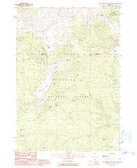
~ Big Mowich Mountain OR topo map, 1:24000 scale, 7.5 X 7.5 Minute, Historical, 1990, updated 1990
Big Mowich Mountain, Oregon, USGS topographic map dated 1990.
Includes geographic coordinates (latitude and longitude). This topographic map is suitable for hiking, camping, and exploring, or framing it as a wall map.
Printed on-demand using high resolution imagery, on heavy weight and acid free paper, or alternatively on a variety of synthetic materials.
Topos available on paper, Waterproof, Poly, or Tyvek. Usually shipping rolled, unless combined with other folded maps in one order.
- Product Number: USGS-5416710
- Free digital map download (high-resolution, GeoPDF): Big Mowich Mountain, Oregon (file size: 11 MB)
- Map Size: please refer to the dimensions of the GeoPDF map above
- Weight (paper map): ca. 55 grams
- Map Type: POD USGS Topographic Map
- Map Series: HTMC
- Map Verison: Historical
- Cell ID: 3783
- Scan ID: 279025
- Imprint Year: 1990
- Woodland Tint: Yes
- Aerial Photo Year: 1984
- Edit Year: 1990
- Field Check Year: 1986
- Datum: NAD27
- Map Projection: Lambert Conformal Conic
- Provisional map: Yes
- Map published by United States Geological Survey
- Map Language: English
- Scanner Resolution: 600 dpi
- Map Cell Name: Big Mowich Mountain
- Grid size: 7.5 X 7.5 Minute
- Date on map: 1990
- Map Scale: 1:24000
- Geographical region: Oregon, United States
Neighboring Maps:
All neighboring USGS topo maps are available for sale online at a variety of scales.
Spatial coverage:
Topo map Big Mowich Mountain, Oregon, covers the geographical area associated the following places:
- Pendleton Spring - Stinking Spring - Mud Spring - Allen Spring - Allison Creek - Silver Spring - Boundary Spring - Snow Mountain Spring - Button Flat - Round Meadow Spring - Fir Tree Spring - Fine Spring - Porcupine Spring - Button Flat Spring - Allison Guard Station - Allison Ranch - Pole Camp Spring - Snow Spring - Freeman Creek - Robertson Ranch - Willow Spring - Beaver Reservoir - Big Mowich Mountain - Swain Prairie Spring - Blue Jay Spring - Whistle Spring - Moco Spring - Little Mowich Mountain - Fawn Spring - DK Spring - Robertson Ridge - Lehman Meadow - Allison Ranger Station - Jessie Spring - Weburg Spring - Timothy Spring - Mutton Camp - Whistle Creek - Clear Creek - J M Ranch - Tamarack Creek - Adams Spring - Allison Spring - Dobson Spring - Mowich Spring - Dobson Creek - Howard Valley - Upper Crowsfoot Spring - Culvert Spring - Helens Spring - Sourdough Spring - Harris Ranch
- Map Area ID: AREA4443.875-119.625-119.5
- Northwest corner Lat/Long code: USGSNW44-119.625
- Northeast corner Lat/Long code: USGSNE44-119.5
- Southwest corner Lat/Long code: USGSSW43.875-119.625
- Southeast corner Lat/Long code: USGSSE43.875-119.5
- Northern map edge Latitude: 44
- Southern map edge Latitude: 43.875
- Western map edge Longitude: -119.625
- Eastern map edge Longitude: -119.5


