
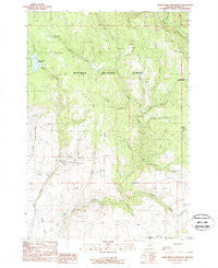
~ Balm Creek Reservoir OR topo map, 1:24000 scale, 7.5 X 7.5 Minute, Historical, 1988, updated 1988
Balm Creek Reservoir, Oregon, USGS topographic map dated 1988.
Includes geographic coordinates (latitude and longitude). This topographic map is suitable for hiking, camping, and exploring, or framing it as a wall map.
Printed on-demand using high resolution imagery, on heavy weight and acid free paper, or alternatively on a variety of synthetic materials.
Topos available on paper, Waterproof, Poly, or Tyvek. Usually shipping rolled, unless combined with other folded maps in one order.
- Product Number: USGS-5416540
- Free digital map download (high-resolution, GeoPDF): Balm Creek Reservoir, Oregon (file size: 14 MB)
- Map Size: please refer to the dimensions of the GeoPDF map above
- Weight (paper map): ca. 55 grams
- Map Type: POD USGS Topographic Map
- Map Series: HTMC
- Map Verison: Historical
- Cell ID: 2283
- Scan ID: 278935
- Imprint Year: 1988
- Woodland Tint: Yes
- Aerial Photo Year: 1984
- Edit Year: 1988
- Field Check Year: 1985
- Datum: NAD27
- Map Projection: Lambert Conformal Conic
- Provisional map: Yes
- Map published by United States Geological Survey
- Map Language: English
- Scanner Resolution: 600 dpi
- Map Cell Name: Balm Creek Reservoir
- Grid size: 7.5 X 7.5 Minute
- Date on map: 1988
- Map Scale: 1:24000
- Geographical region: Oregon, United States
Neighboring Maps:
All neighboring USGS topo maps are available for sale online at a variety of scales.
Spatial coverage:
Topo map Balm Creek Reservoir, Oregon, covers the geographical area associated the following places:
- Balm Creek Reservoir Boat Launch - Balm Creek Dam - Sawmill Creek - Sucker Creek - Balm Creek Shaft - Red Ridge - Red Gulch - Sheep Creek - Phillips Ditch - Goslin Corral - Sanger Gulch - Cottonwood Creek - Rattlesnake Creek - Red Knob - Lily White Guard Station - Ledge Creek - Balm Creek Reservoir Recreation Site - Slide Creek - Poorman Mine - Sanger Post Office (historical) - Lost Gulch - Union Spring - Dark Canyon - Forshey Meadow - Bennett Creek - Forshey Creek - Cougar Creek - Surprise Springs Rural Fire and Rescue - Daddy Lode Mine - O'Brien Creek - Sanger Mine - West Fork Goose Creek - Larkspur Creek - Saw Mill Gulch Dam - Bradley Creek - Gover Reservoir - East Fork Goose Creek - Arthur Post Office (historical) - Balm Creek Reservoir - Surprise Spring - Goose Lake
- Map Area ID: AREA4544.875-117.5-117.375
- Northwest corner Lat/Long code: USGSNW45-117.5
- Northeast corner Lat/Long code: USGSNE45-117.375
- Southwest corner Lat/Long code: USGSSW44.875-117.5
- Southeast corner Lat/Long code: USGSSE44.875-117.375
- Northern map edge Latitude: 45
- Southern map edge Latitude: 44.875
- Western map edge Longitude: -117.5
- Eastern map edge Longitude: -117.375


