
~ Baldy Mtn OR topo map, 1:24000 scale, 7.5 X 7.5 Minute, Historical, 1984, updated 1984
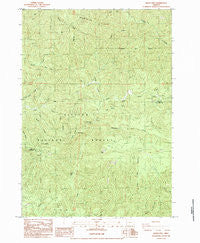
Baldy Mtn, Oregon, USGS topographic map dated 1984.
Includes geographic coordinates (latitude and longitude). This topographic map is suitable for hiking, camping, and exploring, or framing it as a wall map.
Printed on-demand using high resolution imagery, on heavy weight and acid free paper, or alternatively on a variety of synthetic materials.
Topos available on paper, Waterproof, Poly, or Tyvek. Usually shipping rolled, unless combined with other folded maps in one order.
- Product Number: USGS-5416514
- Free digital map download (high-resolution, GeoPDF): Baldy Mtn, Oregon (file size: 18 MB)
- Map Size: please refer to the dimensions of the GeoPDF map above
- Weight (paper map): ca. 55 grams
- Map Type: POD USGS Topographic Map
- Map Series: HTMC
- Map Verison: Historical
- Cell ID: 2252
- Scan ID: 278922
- Imprint Year: 1984
- Woodland Tint: Yes
- Aerial Photo Year: 1976
- Edit Year: 1984
- Field Check Year: 1979
- Datum: NAD27
- Map Projection: Lambert Conformal Conic
- Provisional map: Yes
- Map published by United States Geological Survey
- Map Language: English
- Scanner Resolution: 600 dpi
- Map Cell Name: Baldy Mountain
- Grid size: 7.5 X 7.5 Minute
- Date on map: 1984
- Map Scale: 1:24000
- Geographical region: Oregon, United States
Neighboring Maps:
All neighboring USGS topo maps are available for sale online at a variety of scales.
Spatial coverage:
Topo map Baldy Mtn, Oregon, covers the geographical area associated the following places:
- Lloyd Creek - Hand Creek - Ryan Creek - Ord Post Office (historical) - Table Rock - Sheep Herder Creek - Hand Ridge - Sulphur Creek - Middle Fork North Fork Smith River - Hood Creek - Deer Creek - Smith River Recreation Site (historical) - Smittie Ridge - South Fork Sweet Creek - North Fork Falls - Jump Creek - Mount Grayback - Lower Kentucky Falls - Kentucky Creek - Upper Kentucky Falls - Baldy Mountain
- Map Area ID: AREA4443.875-123.875-123.75
- Northwest corner Lat/Long code: USGSNW44-123.875
- Northeast corner Lat/Long code: USGSNE44-123.75
- Southwest corner Lat/Long code: USGSSW43.875-123.875
- Southeast corner Lat/Long code: USGSSE43.875-123.75
- Northern map edge Latitude: 44
- Southern map edge Latitude: 43.875
- Western map edge Longitude: -123.875
- Eastern map edge Longitude: -123.75


