
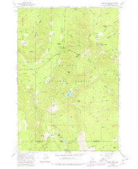
~ Badger Lake OR topo map, 1:24000 scale, 7.5 X 7.5 Minute, Historical, 1979
Badger Lake, Oregon, USGS topographic map dated 1979.
Includes geographic coordinates (latitude and longitude). This topographic map is suitable for hiking, camping, and exploring, or framing it as a wall map.
Printed on-demand using high resolution imagery, on heavy weight and acid free paper, or alternatively on a variety of synthetic materials.
Topos available on paper, Waterproof, Poly, or Tyvek. Usually shipping rolled, unless combined with other folded maps in one order.
- Product Number: USGS-5416494
- Free digital map download (high-resolution, GeoPDF): Badger Lake, Oregon (file size: 12 MB)
- Map Size: please refer to the dimensions of the GeoPDF map above
- Weight (paper map): ca. 55 grams
- Map Type: POD USGS Topographic Map
- Map Series: HTMC
- Map Verison: Historical
- Cell ID: 2087
- Scan ID: 278912
- Woodland Tint: Yes
- Visual Version Number: 1
- Photo Revision Year: 1979
- Aerial Photo Year: 1973
- Edit Year: 1979
- Field Check Year: 1962
- Datum: NAD27
- Map Projection: Polyconic
- Map published by United States Geological Survey
- Map Language: English
- Scanner Resolution: 600 dpi
- Map Cell Name: Badger Lake
- Grid size: 7.5 X 7.5 Minute
- Date on map: 1979
- Map Scale: 1:24000
- Geographical region: Oregon, United States
Neighboring Maps:
All neighboring USGS topo maps are available for sale online at a variety of scales.
Spatial coverage:
Topo map Badger Lake, Oregon, covers the geographical area associated the following places:
- Dog River Springs - Valley View Cabin - Robinhood Quarry - Boulder Lake - Badger Lake Recreation Site - Elk Mountain - Buck Draw - Elk Meadows Trail - Gunsight Butte - Robinhood Recreation Site - Bluegrass Ridge - Engineers Creek - Spinning Lake - Gumjuwac Creek - Pocket Creek - Tolo Creek - Badger Lake - Newton Creek - Meadows Creek - Gumjuwac Saddle - Jean Lake - Robinhood Guard Station - Lunch Creek - Badger Lake Dam - Jalland Creek - Robinhood Creek - High Prairie - Boulder Lake Way Trail - Boulder Lake Trail - South Fork Cold Spring Creek - Hellroaring Creek - Jack Springs - Rocky Butte - Kane Springs - Grasshopper Point - Flag Point Trail - Nottingham Campground - Pine Creek Trail - Crane Prairie - Elk Meadows - Camp Windy Recreation Site - Clark Creek - Lookout Mountain Trail - Badger Butte - Iron Creek - Boulder Lake Recreation Site - Bonney Meadows Recreation Site - Mine Creek - Rocky Butte Way Trail - Horsethief Meadows - Bonney Butte - Lookout Mountain - Senecal Spring - Bonney Meadows - Echo Point
- Map Area ID: AREA45.37545.25-121.625-121.5
- Northwest corner Lat/Long code: USGSNW45.375-121.625
- Northeast corner Lat/Long code: USGSNE45.375-121.5
- Southwest corner Lat/Long code: USGSSW45.25-121.625
- Southeast corner Lat/Long code: USGSSE45.25-121.5
- Northern map edge Latitude: 45.375
- Southern map edge Latitude: 45.25
- Western map edge Longitude: -121.625
- Eastern map edge Longitude: -121.5


