
~ Arkansas Flat OR topo map, 1:24000 scale, 7.5 X 7.5 Minute, Historical, 2004, updated 2007
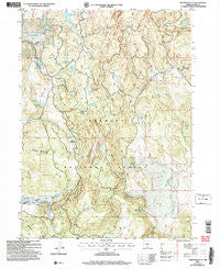
Arkansas Flat, Oregon, USGS topographic map dated 2004.
Includes geographic coordinates (latitude and longitude). This topographic map is suitable for hiking, camping, and exploring, or framing it as a wall map.
Printed on-demand using high resolution imagery, on heavy weight and acid free paper, or alternatively on a variety of synthetic materials.
Topos available on paper, Waterproof, Poly, or Tyvek. Usually shipping rolled, unless combined with other folded maps in one order.
- Product Number: USGS-5416432
- Free digital map download (high-resolution, GeoPDF): Arkansas Flat, Oregon (file size: 16 MB)
- Map Size: please refer to the dimensions of the GeoPDF map above
- Weight (paper map): ca. 55 grams
- Map Type: POD USGS Topographic Map
- Map Series: HTMC
- Map Verison: Historical
- Cell ID: 1428
- Scan ID: 278880
- Imprint Year: 2007
- Woodland Tint: Yes
- Aerial Photo Year: 2001
- Edit Year: 2004
- Datum: NAD83
- Map Projection: Universal Transverse Mercator
- Map published by United States Geological Survey
- Map published by United States Forest Service
- Map Language: English
- Scanner Resolution: 600 dpi
- Map Cell Name: Arkansas Flat
- Grid size: 7.5 X 7.5 Minute
- Date on map: 2004
- Map Scale: 1:24000
- Geographical region: Oregon, United States
Neighboring Maps:
All neighboring USGS topo maps are available for sale online at a variety of scales.
Spatial coverage:
Topo map Arkansas Flat, Oregon, covers the geographical area associated the following places:
- Horsehead Spring - Arkansas Dam - Lookout Spring - Squaw Flat - Lapham Ranch - June Spring - Big Cove - Lapham Reservoir - Buzzard Roost Spring - Pitt Lake Dam - Deer Spring - Holmes Meadow - Pitt Lake - Wilson Creek - Juniper Mountain - Dry Valley - Utley Ranch - Blue Monday Spring - Road Bend Spring - Long Prairie - Secret Valley - Barnes Rim - Red Rock Spring - Big Swamp Reservoir - Strawberry Creek - Lapham Dam - July Spring - Lower Pitt Lake - Davis Lake - Arkansas Flat - Bear Wallows - Albertson Spring - Big Swamp Creek - Harry Spring - Upset Spring - Big Swamp Dam - Creed Field - Sullivan Spring - Hoyts Hole - Court Spring - Walker Lake - Arkansas Reservoir - Arkansas Spring - Bachelor Creek - Aspen Ridge Trailhead
- Map Area ID: AREA42.2542.125-120.875-120.75
- Northwest corner Lat/Long code: USGSNW42.25-120.875
- Northeast corner Lat/Long code: USGSNE42.25-120.75
- Southwest corner Lat/Long code: USGSSW42.125-120.875
- Southeast corner Lat/Long code: USGSSE42.125-120.75
- Northern map edge Latitude: 42.25
- Southern map edge Latitude: 42.125
- Western map edge Longitude: -120.875
- Eastern map edge Longitude: -120.75


