
~ Aldrich Mountain North OR topo map, 1:24000 scale, 7.5 X 7.5 Minute, Historical, 1972, updated 1984
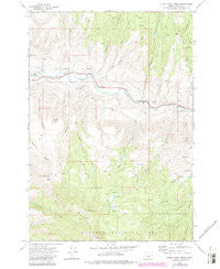
Aldrich Mountain North, Oregon, USGS topographic map dated 1972.
Includes geographic coordinates (latitude and longitude). This topographic map is suitable for hiking, camping, and exploring, or framing it as a wall map.
Printed on-demand using high resolution imagery, on heavy weight and acid free paper, or alternatively on a variety of synthetic materials.
Topos available on paper, Waterproof, Poly, or Tyvek. Usually shipping rolled, unless combined with other folded maps in one order.
- Product Number: USGS-5416302
- Free digital map download (high-resolution, GeoPDF): Aldrich Mountain North, Oregon (file size: 14 MB)
- Map Size: please refer to the dimensions of the GeoPDF map above
- Weight (paper map): ca. 55 grams
- Map Type: POD USGS Topographic Map
- Map Series: HTMC
- Map Verison: Historical
- Cell ID: 483
- Scan ID: 278815
- Imprint Year: 1984
- Woodland Tint: Yes
- Photo Revision Year: 1983
- Aerial Photo Year: 1981
- Edit Year: 1983
- Field Check Year: 1972
- Datum: NAD27
- Map Projection: Lambert Conformal Conic
- Map published by United States Geological Survey
- Map Language: English
- Scanner Resolution: 600 dpi
- Map Cell Name: Aldrich Mountain North
- Grid size: 7.5 X 7.5 Minute
- Date on map: 1972
- Map Scale: 1:24000
- Geographical region: Oregon, United States
Neighboring Maps:
All neighboring USGS topo maps are available for sale online at a variety of scales.
Spatial coverage:
Topo map Aldrich Mountain North, Oregon, covers the geographical area associated the following places:
- Stewart Ditch - Little Aldrich Mountain - Roosevelt Lake - Marks Creek - Little Bridge Creek - Murray Creek - Left Fork Scotty Creek - Stockdale Creek - Schoolhouse Gulch - Aldrich Creek - Flat Creek - Wiley Creek - Aldrich Mountain - Stewart Lake - Bridge Creek - Scotty Creek - Pinchot Lake - Chicken Springs - Dead Pine - Aldrich Grave - Chilkoot Pass - Stewarts Crossing - Lick Spring
- Map Area ID: AREA44.544.375-119.5-119.375
- Northwest corner Lat/Long code: USGSNW44.5-119.5
- Northeast corner Lat/Long code: USGSNE44.5-119.375
- Southwest corner Lat/Long code: USGSSW44.375-119.5
- Southeast corner Lat/Long code: USGSSE44.375-119.375
- Northern map edge Latitude: 44.5
- Southern map edge Latitude: 44.375
- Western map edge Longitude: -119.5
- Eastern map edge Longitude: -119.375


