
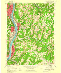
~ Steubenville East OH topo map, 1:24000 scale, 7.5 X 7.5 Minute, Historical, 1958, updated 1959
Steubenville East, Ohio, USGS topographic map dated 1958.
Includes geographic coordinates (latitude and longitude). This topographic map is suitable for hiking, camping, and exploring, or framing it as a wall map.
Printed on-demand using high resolution imagery, on heavy weight and acid free paper, or alternatively on a variety of synthetic materials.
Topos available on paper, Waterproof, Poly, or Tyvek. Usually shipping rolled, unless combined with other folded maps in one order.
- Product Number: USGS-5414318
- Free digital map download (high-resolution, GeoPDF): Steubenville East, Ohio (file size: 13 MB)
- Map Size: please refer to the dimensions of the GeoPDF map above
- Weight (paper map): ca. 55 grams
- Map Type: POD USGS Topographic Map
- Map Series: HTMC
- Map Verison: Historical
- Cell ID: 43144
- Scan ID: 701479
- Imprint Year: 1959
- Woodland Tint: Yes
- Aerial Photo Year: 1954
- Field Check Year: 1958
- Datum: NAD27
- Map Projection: Polyconic
- Map published by United States Geological Survey
- Map Language: English
- Scanner Resolution: 508 dpi
- Map Cell Name: Steubenville East
- Grid size: 7.5 X 7.5 Minute
- Date on map: 1958
- Map Scale: 1:24000
- Geographical region: Ohio, United States
Neighboring Maps:
All neighboring USGS topo maps are available for sale online at a variety of scales.
Spatial coverage:
Topo map Steubenville East, Ohio, covers the geographical area associated the following places:
- Marshall Terrace - Chapman Addition - Archer Heights - Duvall's Trailer Park - Virginville - Rockdale - Colliers - Rabbit Hill - East Steubenville - Louise - Scott Run - Longview Heights - Lazearville - Arnold - Follansbee - Dutch Town - Independence - Shank Town - Altamont - The Orchard - Fowlerstown - Wellsburg - Penowa - Hooverson Heights - Jeffersonville (historical) - Parkview - Franklin - Jacksonville - Deandale - Coketown - Moores Trailer Park - La Belle View - Mingo Junction
- Map Area ID: AREA40.37540.25-80.625-80.5
- Northwest corner Lat/Long code: USGSNW40.375-80.625
- Northeast corner Lat/Long code: USGSNE40.375-80.5
- Southwest corner Lat/Long code: USGSSW40.25-80.625
- Southeast corner Lat/Long code: USGSSE40.25-80.5
- Northern map edge Latitude: 40.375
- Southern map edge Latitude: 40.25
- Western map edge Longitude: -80.625
- Eastern map edge Longitude: -80.5


