
~ Nickel Mountain OR topo map, 1:24000 scale, 7.5 X 7.5 Minute, Historical, 2011
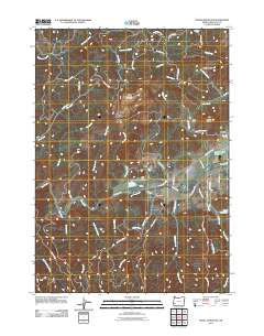
Nickel Mountain, Oregon, USGS topographic map dated 2011.
Includes geographic coordinates (latitude and longitude). This topographic map is suitable for hiking, camping, and exploring, or framing it as a wall map.
Printed on-demand using high resolution imagery, on heavy weight and acid free paper, or alternatively on a variety of synthetic materials.
Topos available on paper, Waterproof, Poly, or Tyvek. Usually shipping rolled, unless combined with other folded maps in one order.
- Product Number: USGS-5411914
- Free digital map download (high-resolution, GeoPDF): Nickel Mountain, Oregon (file size: 25 MB)
- Map Size: please refer to the dimensions of the GeoPDF map above
- Weight (paper map): ca. 55 grams
- Map Type: POD USGS Topographic Map
- Map Series: US Topo
- Map Verison: Historical
- Cell ID: 32075
- Datum: North American Datum of 1983
- Map Projection: Transverse Mercator
- Map Cell Name: Nickel Mountain
- Grid size: 7.5 X 7.5 Minute
- Date on map: 2011
- Map Scale: 1:24000
- Geographical region: Oregon, United States
Neighboring Maps:
All neighboring USGS topo maps are available for sale online at a variety of scales.
Spatial coverage:
Topo map Nickel Mountain, Oregon, covers the geographical area associated the following places:
- Island Creek - Boomer Hill - Crawford Branch - Russell Creek - Jerry Creek - Salt Creek - Rail Gulch - Cornutt - Little Doe Creek - Catching Creek - China Creek - Council Creek - Riddle Cemetery - Langell Ridge - Rattlesnake Creek - Sanderson Brook - Lake Stomar Reservoir - Mount Isaac - Glenbrook - Alder Creek - Jerry Flat - Squaw Creek - Beatty Creek - Hanna Mine - Nickel Mountain (historical)
- Map Area ID: AREA4342.875-123.5-123.375
- Northwest corner Lat/Long code: USGSNW43-123.5
- Northeast corner Lat/Long code: USGSNE43-123.375
- Southwest corner Lat/Long code: USGSSW42.875-123.5
- Southeast corner Lat/Long code: USGSSE42.875-123.375
- Northern map edge Latitude: 43
- Southern map edge Latitude: 42.875
- Western map edge Longitude: -123.5
- Eastern map edge Longitude: -123.375


