
~ Olds Ferry ID topo map, 1:24000 scale, 7.5 X 7.5 Minute, Historical, 2011
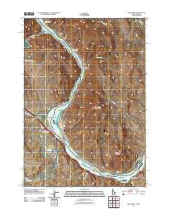
Olds Ferry, Idaho, USGS topographic map dated 2011.
Includes geographic coordinates (latitude and longitude). This topographic map is suitable for hiking, camping, and exploring, or framing it as a wall map.
Printed on-demand using high resolution imagery, on heavy weight and acid free paper, or alternatively on a variety of synthetic materials.
Topos available on paper, Waterproof, Poly, or Tyvek. Usually shipping rolled, unless combined with other folded maps in one order.
- Product Number: USGS-5411844
- Free digital map download (high-resolution, GeoPDF): Olds Ferry, Idaho (file size: 18 MB)
- Map Size: please refer to the dimensions of the GeoPDF map above
- Weight (paper map): ca. 55 grams
- Map Type: POD USGS Topographic Map
- Map Series: US Topo
- Map Verison: Historical
- Cell ID: 33126
- Datum: North American Datum of 1983
- Map Projection: Transverse Mercator
- Map Cell Name: Olds Ferry
- Grid size: 7.5 X 7.5 Minute
- Date on map: 2011
- Map Scale: 1:24000
- Geographical region: Idaho, United States
Neighboring Maps:
All neighboring USGS topo maps are available for sale online at a variety of scales.
Spatial coverage:
Topo map Olds Ferry, Idaho, covers the geographical area associated the following places:
- McBride Reservoir - Benson Interchange - Crawford Place - Coal Mine Gulch - Birch Creek - Olds Ferry - McBride Ditch - Road Gulch - Slaughterhouse Range - Farewell Bend (historical) - Farewell Bend Post Office (historical) - Farewell Bend - Grouse Creek - Devils Hole - Blakes Junction (historical) - Blakes (historical) - Oasis RV Park Boat Ramp - Farewell Bend State Park Boat Ramp - Rock Island - Reiber Spring - Farewell Bend - Indian Head Mountain - Hush Spring - Nagle (historical) - Wheel Gulch - Farewell Bend State Park - Darrows Islands - Chicken Creek - Blakes Junction - Huffman Island - Dead Indian Ridge - Rock Island Station - Benson Creek - Burnt River - Slaughterhouse Spring
- Map Area ID: AREA44.37544.25-117.25-117.125
- Northwest corner Lat/Long code: USGSNW44.375-117.25
- Northeast corner Lat/Long code: USGSNE44.375-117.125
- Southwest corner Lat/Long code: USGSSW44.25-117.25
- Southeast corner Lat/Long code: USGSSE44.25-117.125
- Northern map edge Latitude: 44.375
- Southern map edge Latitude: 44.25
- Western map edge Longitude: -117.25
- Eastern map edge Longitude: -117.125


