
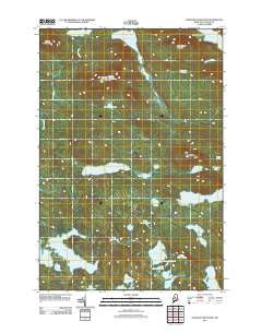
~ Wadleigh Mountain ME topo map, 1:24000 scale, 7.5 X 7.5 Minute, Historical, 2011
Wadleigh Mountain, Maine, USGS topographic map dated 2011.
Includes geographic coordinates (latitude and longitude). This topographic map is suitable for hiking, camping, and exploring, or framing it as a wall map.
Printed on-demand using high resolution imagery, on heavy weight and acid free paper, or alternatively on a variety of synthetic materials.
Topos available on paper, Waterproof, Poly, or Tyvek. Usually shipping rolled, unless combined with other folded maps in one order.
- Product Number: USGS-5411692
- Free digital map download (high-resolution, GeoPDF): Wadleigh Mountain, Maine (file size: 29 MB)
- Map Size: please refer to the dimensions of the GeoPDF map above
- Weight (paper map): ca. 55 grams
- Map Type: POD USGS Topographic Map
- Map Series: US Topo
- Map Verison: Historical
- Cell ID: 47105
- Datum: North American Datum of 1983
- Map Projection: Transverse Mercator
- Map Cell Name: Wadleigh Mountain
- Grid size: 7.5 X 7.5 Minute
- Date on map: 2011
- Map Scale: 1:24000
- Geographical region: Maine, United States
Neighboring Maps:
All neighboring USGS topo maps are available for sale online at a variety of scales.
Spatial coverage:
Topo map Wadleigh Mountain, Maine, covers the geographical area associated the following places:
- Second Musquash Pond - Little Penobscot Pond - Female Mountain - Wadleigh Mountain - Female Pond - Fourth Roach Pond - Third Musquash Pond - Little Pleasant Pond - Wadleigh Mountain Lookout Tower - Penobscot Pond - Harding Pond - Bear Pond - Turtle Ridge - Beaver Pond - Bog Pond - Long Pond - Yoke Ponds - Loon Pond - Prentiss Pond - TA R11 WELS - Rocky Pond - T1 R11 WELS - Sing Sing Pond - Crawford Pond - Wadleigh Pond - Alligator Pond - Birch Ridge Ponds - Big Pleasant Pond - Hedgehog Pond - Farrar Brook - Spruance Pond - First Musquash Pond - Third Roach Pond - Little Rocky Pond - Monkey Pond - Wadleigh Valley - Nesuntabunt Mountain - Seventh Roach Pond
- Map Area ID: AREA45.7545.625-69.25-69.125
- Northwest corner Lat/Long code: USGSNW45.75-69.25
- Northeast corner Lat/Long code: USGSNE45.75-69.125
- Southwest corner Lat/Long code: USGSSW45.625-69.25
- Southeast corner Lat/Long code: USGSSE45.625-69.125
- Northern map edge Latitude: 45.75
- Southern map edge Latitude: 45.625
- Western map edge Longitude: -69.25
- Eastern map edge Longitude: -69.125


