
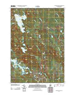
~ Northeast Bluff ME topo map, 1:24000 scale, 7.5 X 7.5 Minute, Historical, 2011
Northeast Bluff, Maine, USGS topographic map dated 2011.
Includes geographic coordinates (latitude and longitude). This topographic map is suitable for hiking, camping, and exploring, or framing it as a wall map.
Printed on-demand using high resolution imagery, on heavy weight and acid free paper, or alternatively on a variety of synthetic materials.
Topos available on paper, Waterproof, Poly, or Tyvek. Usually shipping rolled, unless combined with other folded maps in one order.
- Product Number: USGS-5411600
- Free digital map download (high-resolution, GeoPDF): Northeast Bluff, Maine (file size: 25 MB)
- Map Size: please refer to the dimensions of the GeoPDF map above
- Weight (paper map): ca. 55 grams
- Map Type: POD USGS Topographic Map
- Map Series: US Topo
- Map Verison: Historical
- Cell ID: 32503
- Datum: North American Datum of 1983
- Map Projection: Transverse Mercator
- Map Cell Name: Northeast Bluff
- Grid size: 7.5 X 7.5 Minute
- Date on map: 2011
- Map Scale: 1:24000
- Geographical region: Maine, United States
Neighboring Maps:
All neighboring USGS topo maps are available for sale online at a variety of scales.
Spatial coverage:
Topo map Northeast Bluff, Maine, covers the geographical area associated the following places:
- Dorman Island - Southwest Bluff - Southwest Brook - Pineo Camp - Beech Hill - Southwest Pond - Spruce Mountain Lake Brook - Parker Cove - Pleasant River Lake Water Dam - Bog Brook Flowage - Spruce Ridge - Canoe Brook - Allen Heath - Crebo Flat - Flynn Brook - Hall Ridge - Northeast Bluff - Merrit Brook - T24 MD BPP - Northeast Brook - Allison Worcester Camp - Pretty Pond - Long Pond - Bridgham Swamp - Goose Pond - Beech Hill Brook - Sprague Camp - Merrit Pond - Stewart Camp - Flynn Pond - Morse Camp - Morse Camp - Dick Allen Cove - Oak Pond - Colonel Brook - Knox Hill - Elsie Point - Otter Pond - Davis Camp - Allen Brook - Pleasant River Lake - Irving Worcester Camp - Hartford Camp - Beech Hill Heath - Northeast Hill
- Map Area ID: AREA44.87544.75-68-67.875
- Northwest corner Lat/Long code: USGSNW44.875-68
- Northeast corner Lat/Long code: USGSNE44.875-67.875
- Southwest corner Lat/Long code: USGSSW44.75-68
- Southeast corner Lat/Long code: USGSSE44.75-67.875
- Northern map edge Latitude: 44.875
- Southern map edge Latitude: 44.75
- Western map edge Longitude: -68
- Eastern map edge Longitude: -67.875


