
~ Great Wass Island ME topo map, 1:24000 scale, 7.5 X 7.5 Minute, Historical, 2011
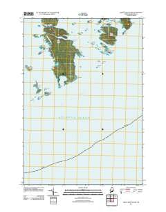
Great Wass Island, Maine, USGS topographic map dated 2011.
Includes geographic coordinates (latitude and longitude). This topographic map is suitable for hiking, camping, and exploring, or framing it as a wall map.
Printed on-demand using high resolution imagery, on heavy weight and acid free paper, or alternatively on a variety of synthetic materials.
Topos available on paper, Waterproof, Poly, or Tyvek. Usually shipping rolled, unless combined with other folded maps in one order.
- Product Number: USGS-5411582
- Free digital map download (high-resolution, GeoPDF): Great Wass Island, Maine (file size: 10 MB)
- Map Size: please refer to the dimensions of the GeoPDF map above
- Weight (paper map): ca. 55 grams
- Map Type: POD USGS Topographic Map
- Map Series: US Topo
- Map Verison: Historical
- Cell ID: 18298
- Datum: North American Datum of 1983
- Map Projection: Transverse Mercator
- Map Cell Name: Great Wass Island
- Grid size: 7.5 X 7.5 Minute
- Date on map: 2011
- Map Scale: 1:24000
- Geographical region: Maine, United States
Neighboring Maps:
All neighboring USGS topo maps are available for sale online at a variety of scales.
Spatial coverage:
Topo map Great Wass Island, Maine, covers the geographical area associated the following places:
- Green Island - Curlew Rock - Browney Island - Little Pond Head - Popplestone Ledge - Eastern Bay - Red Head - Money Island - Town of Beals - Mud Hole Point - Mud Hole Channel - Little Peabody Island - Mash Island - The Cows Yard - Big Peabody Island - Norton Ledge - Moose Peak Light - Upper Herring Cove - Freeman Rock - Great Wass Island Preserve - Sand Cove - Mud Hole Trail - Hall Cove - Seal Rock - Head Harbor - Black Island - Green Rock - Cape Cove - Crumple Island - Sand Cove North - The Pond - Hall Island - Calf Island - Three Falls Point - Slate Island - Slate Island Cove - Knight Island - Mistake Island - Folkingham Cove - Fisherman Island - Deep Cove - Little Hardwood Island - Main Channel Way - Little Cape Point - Green Island - Mink Island - Great Wass Island - Popplestone Cove - Lower Herring Cove - Alley Point - Three Falls Harbor - Mannings Farm - Steele Harbor Island - Crow Point - Black Head - Channel Rock - Black Ledges - Crow Island - Water Island - Mud Hole - Black Duck Cove - Pond Point - Brim Cove - Man Island - Mistake Harbor - Norton Point
- Map Area ID: AREA44.544.375-67.625-67.5
- Northwest corner Lat/Long code: USGSNW44.5-67.625
- Northeast corner Lat/Long code: USGSNE44.5-67.5
- Southwest corner Lat/Long code: USGSSW44.375-67.625
- Southeast corner Lat/Long code: USGSSE44.375-67.5
- Northern map edge Latitude: 44.5
- Southern map edge Latitude: 44.375
- Western map edge Longitude: -67.625
- Eastern map edge Longitude: -67.5


