
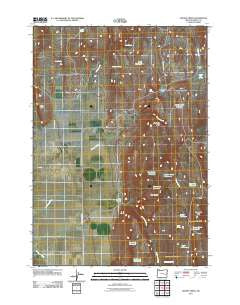
~ Mahon Creek OR topo map, 1:24000 scale, 7.5 X 7.5 Minute, Historical, 2011
Mahon Creek, Oregon, USGS topographic map dated 2011.
Includes geographic coordinates (latitude and longitude). This topographic map is suitable for hiking, camping, and exploring, or framing it as a wall map.
Printed on-demand using high resolution imagery, on heavy weight and acid free paper, or alternatively on a variety of synthetic materials.
Topos available on paper, Waterproof, Poly, or Tyvek. Usually shipping rolled, unless combined with other folded maps in one order.
- Product Number: USGS-5402170
- Free digital map download (high-resolution, GeoPDF): Mahon Creek, Oregon (file size: 17 MB)
- Map Size: please refer to the dimensions of the GeoPDF map above
- Weight (paper map): ca. 55 grams
- Map Type: POD USGS Topographic Map
- Map Series: US Topo
- Map Verison: Historical
- Cell ID: 27273
- Datum: North American Datum of 1983
- Map Projection: Transverse Mercator
- Map Cell Name: Mahon Creek
- Grid size: 7.5 X 7.5 Minute
- Date on map: 2011
- Map Scale: 1:24000
- Geographical region: Oregon, United States
Neighboring Maps:
All neighboring USGS topo maps are available for sale online at a variety of scales.
Spatial coverage:
Topo map Mahon Creek, Oregon, covers the geographical area associated the following places:
- Rock Hill Reservoir - Crane Creek Reservoir - Rector Reservoir - Irving Spring - Laton Point - Mahon Creek - McDonald Waterhole - Rim Rock Reservoir - Bog Spring - Big Spring Draw - Angle Reservoir - Miller Brothers Ranch - McDonald Spring - Devine Flat - Crowcamp Reservoir - Crowcamp Mountain - Rector Spring - Riley Spring - Box Canyon - Mahon Creek Reservoir - Big Spring Reservoir - Aspen Reservoir - Hornbeck Spring - Curtis Creek - Stinkingwater Mountains - Crowcamp Hills - Ritterbusch Flat - Tule Spring - Devine Flat Springs
- Map Area ID: AREA43.62543.5-118.625-118.5
- Northwest corner Lat/Long code: USGSNW43.625-118.625
- Northeast corner Lat/Long code: USGSNE43.625-118.5
- Southwest corner Lat/Long code: USGSSW43.5-118.625
- Southeast corner Lat/Long code: USGSSE43.5-118.5
- Northern map edge Latitude: 43.625
- Southern map edge Latitude: 43.5
- Western map edge Longitude: -118.625
- Eastern map edge Longitude: -118.5


