
~ White Sulphur Springs MT topo map, 1:250000 scale, 1 X 2 Degree, Historical, 1958, updated 1968
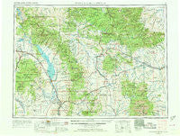
White Sulphur Springs, Montana, USGS topographic map dated 1958.
Includes geographic coordinates (latitude and longitude). This topographic map is suitable for hiking, camping, and exploring, or framing it as a wall map.
Printed on-demand using high resolution imagery, on heavy weight and acid free paper, or alternatively on a variety of synthetic materials.
Topos available on paper, Waterproof, Poly, or Tyvek. Usually shipping rolled, unless combined with other folded maps in one order.
- Product Number: USGS-5402072
- Free digital map download (high-resolution, GeoPDF): White Sulphur Springs, Montana (file size: 22 MB)
- Map Size: please refer to the dimensions of the GeoPDF map above
- Weight (paper map): ca. 55 grams
- Map Type: POD USGS Topographic Map
- Map Series: HTMC
- Map Verison: Historical
- Cell ID: 75029
- Scan ID: 268816
- Imprint Year: 1968
- Woodland Tint: Yes
- Aerial Photo Year: 1958
- Edit Year: 1968
- Datum: Unstated
- Map Projection: Transverse Mercator
- Map published by United States Geological Survey
- Map Language: English
- Scanner Resolution: 600 dpi
- Map Cell Name: White Sulphur Springs
- Grid size: 1 X 2 Degree
- Date on map: 1958
- Map Scale: 1:250000
- Geographical region: Montana, United States
Neighboring Maps:
All neighboring USGS topo maps are available for sale online at a variety of scales.
Spatial coverage:
Topo map White Sulphur Springs, Montana, covers the geographical area associated the following places:
- Hassel - Lebo - Ford Place - Radersburg - Mikesell Trailer Court - Moyne - Lakeside - Martinsdale - Parker - Cameron (historical) - Toston - Diamond City - Lombard - Doak Trailer Court - Springdale Colony - Cavetown - Groveland - Winston - Duncan Ranch Colony - Old Weiss and French Place - Clancy - Four Range - Francis - Ringling - Lingshire - Lennep - Townsend - Clarkston - Fort Logan - Bruno - Alhambra - Bedford - Martinsdale Colony - Hamen - Montana City - Meyersburg (historical) - East Helena - Neihart - Vista - Preston - Elkhorn - Whites City - Moss Agate - Daytown (historical) - Canton - Leisure Village Mobile Home Park - Deep Creek (historical) - Buckingham - Langford City (historical) - Clasoil - Sixteen - Richards Trailer Court - Findon (historical) - Lewiston (historical) - Louisville - McMullan - Gauglersville (historical) - New Haven (historical) - Higgins - Jellison Place - White Sulphur Springs - Twodot - Yogo Crossing - Checkerboard - Nelson - Forest Green - Loweth - Bruce Place - Deer Park - Sapphire Village - Calkins (historical) - Brewer - Tyman Place - Mountain View Trailer Court - Blazing Place - Maudlow - Prairie Mobile Village - Queen - Jerry Mallo Trailer Court - Castle Town - Canyon Ferry - Barker - Robinson - Watson - Bill Bracket Place - Utica - Manger - York - Staley Place - Wolsey - Crow Creek City (historical) - Dennison (historical) - Holker - Noble
- Map Area ID: AREA4746-112-110
- Northwest corner Lat/Long code: USGSNW47-112
- Northeast corner Lat/Long code: USGSNE47-110
- Southwest corner Lat/Long code: USGSSW46-112
- Southeast corner Lat/Long code: USGSSE46-110
- Northern map edge Latitude: 47
- Southern map edge Latitude: 46
- Western map edge Longitude: -112
- Eastern map edge Longitude: -110


