
~ White Sulphur Springs MT topo map, 1:250000 scale, 1 X 2 Degree, Historical, 1965
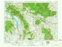
White Sulphur Springs, Montana, USGS topographic map dated 1965.
Includes geographic coordinates (latitude and longitude). This topographic map is suitable for hiking, camping, and exploring, or framing it as a wall map.
Printed on-demand using high resolution imagery, on heavy weight and acid free paper, or alternatively on a variety of synthetic materials.
Topos available on paper, Waterproof, Poly, or Tyvek. Usually shipping rolled, unless combined with other folded maps in one order.
- Product Number: USGS-5402070
- Free digital map download (high-resolution, GeoPDF): White Sulphur Springs, Montana (file size: 23 MB)
- Map Size: please refer to the dimensions of the GeoPDF map above
- Weight (paper map): ca. 55 grams
- Map Type: POD USGS Topographic Map
- Map Series: HTMC
- Map Verison: Historical
- Cell ID: 75029
- Scan ID: 268815
- Woodland Tint: Yes
- Field Check Year: 1958
- Datum: Unstated
- Map Projection: Transverse Mercator
- Map published by United States Geological Survey
- Map Language: English
- Scanner Resolution: 600 dpi
- Map Cell Name: White Sulphur Springs
- Grid size: 1 X 2 Degree
- Date on map: 1965
- Map Scale: 1:250000
- Geographical region: Montana, United States
Neighboring Maps:
All neighboring USGS topo maps are available for sale online at a variety of scales.
Spatial coverage:
Topo map White Sulphur Springs, Montana, covers the geographical area associated the following places:
- Hassel - Leisure Village Mobile Home Park - Moyne - Montana City - Clancy - Holker - White Sulphur Springs - Watson - Sixteen - Ford Place - Meyersburg (historical) - Neihart - Forest Green - Lombard - McMullan - Prairie Mobile Village - Toston - Louisville - Richards Trailer Court - Whites City - Brewer - Old Weiss and French Place - Bedford - Canton - Robinson - East Helena - Ringling - Four Range - Noble - Jellison Place - Barker - Deep Creek (historical) - Hamen - Yogo Crossing - Deer Park - Clasoil - Dennison (historical) - Martinsdale Colony - Higgins - Bruce Place - Nelson - Findon (historical) - Jerry Mallo Trailer Court - Moss Agate - Elkhorn - Francis - Radersburg - Townsend - Blazing Place - Preston - Doak Trailer Court - Bruno - Vista - Tyman Place - Lennep - New Haven (historical) - Queen - Mikesell Trailer Court - Twodot - Lakeside - Springdale Colony - Wolsey - Manger - Cavetown - Lewiston (historical) - Loweth - Alhambra - Duncan Ranch Colony - Lebo - Sapphire Village - Diamond City - Checkerboard - Maudlow - Canyon Ferry - Calkins (historical) - Clarkston - Daytown (historical) - Lingshire - Castle Town - Winston - Staley Place - Gauglersville (historical) - Buckingham - Utica - York - Groveland - Parker - Bill Bracket Place - Martinsdale - Fort Logan - Mountain View Trailer Court - Langford City (historical) - Crow Creek City (historical) - Cameron (historical)
- Map Area ID: AREA4746-112-110
- Northwest corner Lat/Long code: USGSNW47-112
- Northeast corner Lat/Long code: USGSNE47-110
- Southwest corner Lat/Long code: USGSSW46-112
- Southeast corner Lat/Long code: USGSSE46-110
- Northern map edge Latitude: 47
- Southern map edge Latitude: 46
- Western map edge Longitude: -112
- Eastern map edge Longitude: -110


