
~ Shelby MT topo map, 1:250000 scale, 1 X 2 Degree, Historical, 1954, updated 1967
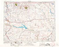
Shelby, Montana, USGS topographic map dated 1954.
Includes geographic coordinates (latitude and longitude). This topographic map is suitable for hiking, camping, and exploring, or framing it as a wall map.
Printed on-demand using high resolution imagery, on heavy weight and acid free paper, or alternatively on a variety of synthetic materials.
Topos available on paper, Waterproof, Poly, or Tyvek. Usually shipping rolled, unless combined with other folded maps in one order.
- Product Number: USGS-5402060
- Free digital map download (high-resolution, GeoPDF): Shelby, Montana (file size: 15 MB)
- Map Size: please refer to the dimensions of the GeoPDF map above
- Weight (paper map): ca. 55 grams
- Map Type: POD USGS Topographic Map
- Map Series: HTMC
- Map Verison: Historical
- Cell ID: 69026
- Scan ID: 268803
- Imprint Year: 1967
- Woodland Tint: Yes
- Edit Year: 1967
- Field Check Year: 1954
- Datum: Unstated
- Map Projection: Transverse Mercator
- Map published by United States Geological Survey
- Map Language: English
- Scanner Resolution: 600 dpi
- Map Cell Name: Shelby
- Grid size: 1 X 2 Degree
- Date on map: 1954
- Map Scale: 1:250000
- Geographical region: Montana, United States
Neighboring Maps:
All neighboring USGS topo maps are available for sale online at a variety of scales.
Spatial coverage:
Topo map Shelby, Montana, covers the geographical area associated the following places:
- Rocky Crossing - Joplin - Brinkman (historical) - Hingham - Shelby - Virgelle - Lothair - Dunkirk - Naismith - Box Elder - Sollid (historical) - Ledger - Tiber - Simpson - Alma (historical) - Spartan Manor Trailer Park - Speer Trailer Park - Selma (historical) - Ashmoor (historical) - Whitlash - Chester - Kippen - Ohio Camp - Big Sandy - Oilmont - Eagle Creek Colony - Inverness - Kenilworth - Tiber Dam Camp - Ferdig - Devon - Saint Johns - Torens Trailer Park - Russell (historical) - McDermott (historical) - Riverview Colony - Galata - Colony Bay (historical) - Gold Butte - Minneota (historical) - George (historical) - Fox Crossing - Big Sandy Trailer Court - Verona - Midway (historical) - Iverness - Buelow - Sunburst - Coal Banks Landing - Sunrise Trailer Court - Hill - Conrad - Lonesome Prairie (historical) - Sage Creek Colony - Rudyard - Fowler - Virden - Genou (historical) - Hay Coulee (historical) - Kevin - Sweet Grass - Brady - Gildford - East Community - Gildford Colony - Old Banks Place - Kremlin - Inga (historical) - Goldstone - Freds Trailer Court
- Map Area ID: AREA4948-112-110
- Northwest corner Lat/Long code: USGSNW49-112
- Northeast corner Lat/Long code: USGSNE49-110
- Southwest corner Lat/Long code: USGSSW48-112
- Southeast corner Lat/Long code: USGSSE48-110
- Northern map edge Latitude: 49
- Southern map edge Latitude: 48
- Western map edge Longitude: -112
- Eastern map edge Longitude: -110


