
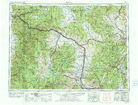
~ Butte MT topo map, 1:250000 scale, 1 X 2 Degree, Historical, 1958, updated 1978
Butte, Montana, USGS topographic map dated 1958.
Includes geographic coordinates (latitude and longitude). This topographic map is suitable for hiking, camping, and exploring, or framing it as a wall map.
Printed on-demand using high resolution imagery, on heavy weight and acid free paper, or alternatively on a variety of synthetic materials.
Topos available on paper, Waterproof, Poly, or Tyvek. Usually shipping rolled, unless combined with other folded maps in one order.
- Product Number: USGS-5401924
- Free digital map download (high-resolution, GeoPDF): Butte, Montana (file size: 28 MB)
- Map Size: please refer to the dimensions of the GeoPDF map above
- Weight (paper map): ca. 55 grams
- Map Type: POD USGS Topographic Map
- Map Series: HTMC
- Map Verison: Historical
- Cell ID: 75030
- Scan ID: 268678
- Imprint Year: 1978
- Woodland Tint: Yes
- Visual Version Number: 1
- Edit Year: 1977
- Field Check Year: 1958
- Datum: Unstated
- Map Projection: Transverse Mercator
- Map published by United States Geological Survey
- Map Language: English
- Scanner Resolution: 600 dpi
- Map Cell Name: Butte
- Grid size: 1 X 2 Degree
- Date on map: 1958
- Map Scale: 1:250000
- Geographical region: Montana, United States
Neighboring Maps:
All neighboring USGS topo maps are available for sale online at a variety of scales.
Spatial coverage:
Topo map Butte, Montana, covers the geographical area associated the following places:
- Wilborn - Baird (historical) - Helena - Anaconda Trailer Court - East Missoula - Beartown - Rumsey - Broadwater - Jens - Bonner Junction - Seven Mile (historical) - Leadville - Ramsay - Mill Creek - Woodville - Garnet - Bald Butte - Centerville - Clark (historical) - Opportunity - Reynolds City - Rocker - Lost Creek - McDonald - McQueen - Bradman - Yreka - Clinton - Copper Cliff - Deer Lodge - Twin Creeks - Stump Town (historical) - Eightmile Saddle - Haskell (historical) - Rimini - Iris - Gold Coin (historical) - Goldcreek - Princeton - Stringtown (historical) - Porters Corner - Blackfoot City (historical) - Allendale (historical) - Hackney - Sieben - East Butte - Nissler - Glenbeg (historical) - Burlington (historical) - Park City - Weed - Forest Heights - Piltzville - Elk Park - Drummond - Pioneer - Sunset Trailer Court - Marysville - Pinegrove Trailer Park - Barite - Circle 'J' Mobile Park - Pinegrove - Dotsonville (historical) - Springtown - Mountain Valley Trailer Court - Hamblin Heights Mobile Village - Silver Lake (historical) - Butchertown (historical) - West Riverside - Skyline - Lincoln - Potomac - Ozan - Staton - Hall - Nimrod - Amazon - Maxville - Mountain View Court - Coughlin - Byrne - AA Westside Mobile Estates - Crackerville - Silver City - Gearing - Burnt Fork (historical) - Garrison - Wickes - Echo Lake (historical) - Ravenna - Top O'Deep - Stuart - Finlen - Mobile City Home Park - Silver Bow Park - Elliston - Wall City - Big Foot (historical) - Corbin - Granite
- Map Area ID: AREA4746-114-112
- Northwest corner Lat/Long code: USGSNW47-114
- Northeast corner Lat/Long code: USGSNE47-112
- Southwest corner Lat/Long code: USGSSW46-114
- Southeast corner Lat/Long code: USGSSE46-112
- Northern map edge Latitude: 47
- Southern map edge Latitude: 46
- Western map edge Longitude: -114
- Eastern map edge Longitude: -112


