
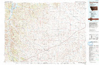
~ Sand Springs MT topo map, 1:100000 scale, 30 X 60 Minute, Historical, 1993, updated 1993
Sand Springs, Montana, USGS topographic map dated 1993.
Includes geographic coordinates (latitude and longitude). This topographic map is suitable for hiking, camping, and exploring, or framing it as a wall map.
Printed on-demand using high resolution imagery, on heavy weight and acid free paper, or alternatively on a variety of synthetic materials.
Topos available on paper, Waterproof, Poly, or Tyvek. Usually shipping rolled, unless combined with other folded maps in one order.
- Product Number: USGS-5401606
- Free digital map download (high-resolution, GeoPDF): Sand Springs, Montana (file size: 29 MB)
- Map Size: please refer to the dimensions of the GeoPDF map above
- Weight (paper map): ca. 55 grams
- Map Type: POD USGS Topographic Map
- Map Series: HTMC
- Map Verison: Historical
- Cell ID: 68313
- Scan ID: 268459
- Imprint Year: 1993
- Woodland Tint: Yes
- Aerial Photo Year: 1986
- Edit Year: 1993
- Datum: NAD27
- Map Projection: Universal Transverse Mercator
- Map published by United States Geological Survey
- Map Language: English
- Scanner Resolution: 600 dpi
- Map Cell Name: Sand Springs
- Grid size: 30 X 60 Minute
- Date on map: 1993
- Map Scale: 1:100000
- Geographical region: Montana, United States
Neighboring Maps:
All neighboring USGS topo maps are available for sale online at a variety of scales.
Spatial coverage:
Topo map Sand Springs, Montana, covers the geographical area associated the following places:
- Benzien - Edwards - Metersville (historical) - McTwiggan (historical) - Tindall (historical) - Chimney Crossing - Sand Springs - Bruce (historical) - Butte Creek (historical) - Blackfoot (historical) - Braggville (historical) - Ross Hall - Smithson (historical) - Anad (historical) - Mecaha (historical) - Steve Forks - Hazny (historical) - Muscleshell City (historical) - Brusett
- Map Area ID: AREA47.547-108-107
- Northwest corner Lat/Long code: USGSNW47.5-108
- Northeast corner Lat/Long code: USGSNE47.5-107
- Southwest corner Lat/Long code: USGSSW47-108
- Southeast corner Lat/Long code: USGSSE47-107
- Northern map edge Latitude: 47.5
- Southern map edge Latitude: 47
- Western map edge Longitude: -108
- Eastern map edge Longitude: -107


