
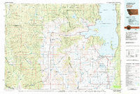
~ Polson MT topo map, 1:100000 scale, 30 X 60 Minute, Historical, 1980, updated 1982
Polson, Montana, USGS topographic map dated 1980.
Includes geographic coordinates (latitude and longitude). This topographic map is suitable for hiking, camping, and exploring, or framing it as a wall map.
Printed on-demand using high resolution imagery, on heavy weight and acid free paper, or alternatively on a variety of synthetic materials.
Topos available on paper, Waterproof, Poly, or Tyvek. Usually shipping rolled, unless combined with other folded maps in one order.
- Product Number: USGS-5401596
- Free digital map download (high-resolution, GeoPDF): Polson, Montana (file size: 29 MB)
- Map Size: please refer to the dimensions of the GeoPDF map above
- Weight (paper map): ca. 55 grams
- Map Type: POD USGS Topographic Map
- Map Series: HTMC
- Map Verison: Historical
- Cell ID: 68172
- Scan ID: 268453
- Imprint Year: 1982
- Woodland Tint: Yes
- Aerial Photo Year: 1977
- Edit Year: 1980
- Datum: NAD27
- Map Projection: Universal Transverse Mercator
- Map published by United States Geological Survey
- Map Language: English
- Scanner Resolution: 600 dpi
- Map Cell Name: Polson
- Grid size: 30 X 60 Minute
- Date on map: 1980
- Map Scale: 1:100000
- Geographical region: Montana, United States
Neighboring Maps:
All neighboring USGS topo maps are available for sale online at a variety of scales.
Spatial coverage:
Topo map Polson, Montana, covers the geographical area associated the following places:
- Elmo - Round Butte - Central Avenue Trailer Court - Weeksville - Rocky Point - Fort Lazy Y Trailer Park - Allard (historical) - Proctor - Jette - Kerr - Sipes - Ronan - Belle-Vue Court - Lonepine - Dunham - Mission Meadows Trailer Park - Lake Mary Ronan - Polson - Hot Springs - Hog Heaven (historical) - Blanchards Corner - Pablo - Mountain View (historical) - Kings Point - Snowberg Court - Meltons - Niarada - Bear Dance - Dayton - Finley Point - Big Arm Mobile Home Park - Big Arm - Turtle Lake - Willow Wynn Trailer Park - Camas - Rollins - Lindisfarne - Spring Valley (historical) - Peaceful Haven Mobile Home Park
- Map Area ID: AREA4847.5-115-114
- Northwest corner Lat/Long code: USGSNW48-115
- Northeast corner Lat/Long code: USGSNE48-114
- Southwest corner Lat/Long code: USGSSW47.5-115
- Southeast corner Lat/Long code: USGSSE47.5-114
- Northern map edge Latitude: 48
- Southern map edge Latitude: 47.5
- Western map edge Longitude: -115
- Eastern map edge Longitude: -114


