
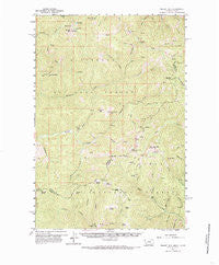
~ Piquett Mtn MT topo map, 1:62500 scale, 15 X 15 Minute, Historical, 1960, updated 1985
Piquett Mtn, Montana, USGS topographic map dated 1960.
Includes geographic coordinates (latitude and longitude). This topographic map is suitable for hiking, camping, and exploring, or framing it as a wall map.
Printed on-demand using high resolution imagery, on heavy weight and acid free paper, or alternatively on a variety of synthetic materials.
Topos available on paper, Waterproof, Poly, or Tyvek. Usually shipping rolled, unless combined with other folded maps in one order.
- Product Number: USGS-5401220
- Free digital map download (high-resolution, GeoPDF): Piquett Mtn, Montana (file size: 11 MB)
- Map Size: please refer to the dimensions of the GeoPDF map above
- Weight (paper map): ca. 55 grams
- Map Type: POD USGS Topographic Map
- Map Series: HTMC
- Map Verison: Historical
- Cell ID: 61029
- Scan ID: 268208
- Imprint Year: 1985
- Woodland Tint: Yes
- Aerial Photo Year: 1954
- Field Check Year: 1960
- Datum: NAD27
- Map Projection: Polyconic
- Map published by United States Geological Survey
- Map Language: English
- Scanner Resolution: 600 dpi
- Map Cell Name: Piquett Mountain
- Grid size: 15 X 15 Minute
- Date on map: 1960
- Map Scale: 1:62500
- Geographical region: Montana, United States
Neighboring Maps:
All neighboring USGS topo maps are available for sale online at a variety of scales.
Spatial coverage:
Topo map Piquett Mtn, Montana, covers the geographical area associated the following places:
- Colter Creek - Drop Creek - Capri Lake - Overwhich Falls - Piquett Mountain - Piquett Lake - Ax Park Way - Quartzite Mountain - Emmett Creek - Allan Creek - Bare Spring - Lake Creek - Robb Gulch - Gentile Creek - Klop Gulch - Mill Gulch - Allan Mountain - Antler Creek - Burrell Creek - Muleshoe Springs - Shelf Lake - Rombo Mountain - Meadow Gulch - Spruce Creek - Gallagher Gulch - Trout Creek - Divide Trail - North Fork Hughes Creek - Cat Creek - Henderson Cabin - Straight Creek - Taylor Creek - Indian Spring - Pass Lake - Taylor Creek Mine - Butcherknife Ridge - Hughes Point - Shields Creek - West Fork Hughes Creek - Taylor Creek Mine - Tincan Spring - Burrell Lake - Ditch Creek - Slate Lake - Bear Wallow Spring - Irishmans Rock - Allan Lake - Chrandal Creek - Rocky Mountain - Falls Point - Humbug Creek - Grizzly Spring - Corner Creek - Jew Mountain - Salzer Creek - Angle Creek - Ax Park - Dan Creek - Jew Mountain Mine - Kyke Creek - McConn Creek - Hughes Creek Placer Mine - Christmas Tree Creek - Frog Pond Lake - Kraft Gulch - Wiles Peak - Mine Creek - Salzer Bar - Tincup Spring - Nicol Creek - Henderson Ridge
- Map Area ID: AREA45.7545.5-114.25-114
- Northwest corner Lat/Long code: USGSNW45.75-114.25
- Northeast corner Lat/Long code: USGSNE45.75-114
- Southwest corner Lat/Long code: USGSSW45.5-114.25
- Southeast corner Lat/Long code: USGSSE45.5-114
- Northern map edge Latitude: 45.75
- Southern map edge Latitude: 45.5
- Western map edge Longitude: -114.25
- Eastern map edge Longitude: -114


