
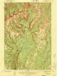
~ Mt Wallace MT topo map, 1:62500 scale, 15 X 15 Minute, Historical, 1943
Mt Wallace, Montana, USGS topographic map dated 1943.
Includes geographic coordinates (latitude and longitude). This topographic map is suitable for hiking, camping, and exploring, or framing it as a wall map.
Printed on-demand using high resolution imagery, on heavy weight and acid free paper, or alternatively on a variety of synthetic materials.
Topos available on paper, Waterproof, Poly, or Tyvek. Usually shipping rolled, unless combined with other folded maps in one order.
- Product Number: USGS-5401166
- Free digital map download (high-resolution, GeoPDF): Mt Wallace, Montana (file size: 10 MB)
- Map Size: please refer to the dimensions of the GeoPDF map above
- Weight (paper map): ca. 55 grams
- Map Type: POD USGS Topographic Map
- Map Series: HTMC
- Map Verison: Historical
- Cell ID: 58143
- Scan ID: 268175
- Woodland Tint: Yes
- Survey Year: 1940
- Datum: NAD27
- Map Projection: Polyconic
- Map published by United States Geological Survey
- Map Language: English
- Scanner Resolution: 600 dpi
- Map Cell Name: Mount Wallace
- Grid size: 15 X 15 Minute
- Date on map: 1943
- Map Scale: 1:62500
- Geographical region: Montana, United States
Neighboring Maps:
All neighboring USGS topo maps are available for sale online at a variety of scales.
Spatial coverage:
Topo map Mt Wallace, Montana, covers the geographical area associated the following places:
- Hellroaring Mountain - Copper Creek - Middle Fork Hellroaring Creek - Silver Creek - Red Rock Plateau - Silver Creek - Mount Wallace - Wallace Creek - Hummingbird Peak - East Fork Wallace Creek - East Fork Buffalo Fork - Hidden Lake - Specimen Falls - West Fork Horse Creek - South Fork Sheep Creek - Hyman Creek - Clover Basin - North Fork Basin - Elk Creek - Buffalo Fork Ranger Station - Grizzly Creek - Bull Mountain - Clover Creek - Gardiner-Cooke City Division - Elk Lake - Colley Lake - Middle Ridge - Buffalo Butte - Elk Creek - Passage Falls - Knife Creek - Maxwell Post Office (historical) - West Fork Buffalo Creek - Cat Creek - Iron Mountain - Buffalo Plateau Patrol Cabin - Brundage Creek - Horse Mountain - Hellroaring Ranger Station - Bull Moose Cabin - Telephone Basin - Buffalo Plateau - East Fork Basin - East Fork Hellroaring Creek - Basin Creek - East Branch Hellroaring Creek - Specimen Creek - Grassy Creek - Silver Basin - Coyote Creek Trail - Hummingbird Basin - Horse Creek - The Hole - Elk Creek Basin - North Fork Hellroaring Creek - Sheep Creek - Carpenter Lake - North Fork Clover Creek - Second Fork West Fork Buffalo Fork - Poacher Trail - Beaver Creek
- Map Area ID: AREA45.2545-110.5-110.25
- Northwest corner Lat/Long code: USGSNW45.25-110.5
- Northeast corner Lat/Long code: USGSNE45.25-110.25
- Southwest corner Lat/Long code: USGSSW45-110.5
- Southeast corner Lat/Long code: USGSSE45-110.25
- Northern map edge Latitude: 45.25
- Southern map edge Latitude: 45
- Western map edge Longitude: -110.5
- Eastern map edge Longitude: -110.25


