
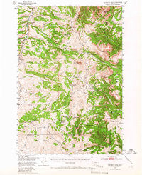
~ Monument Ridge MT topo map, 1:62500 scale, 15 X 15 Minute, Historical, 1950, updated 1966
Monument Ridge, Montana, USGS topographic map dated 1950.
Includes geographic coordinates (latitude and longitude). This topographic map is suitable for hiking, camping, and exploring, or framing it as a wall map.
Printed on-demand using high resolution imagery, on heavy weight and acid free paper, or alternatively on a variety of synthetic materials.
Topos available on paper, Waterproof, Poly, or Tyvek. Usually shipping rolled, unless combined with other folded maps in one order.
- Product Number: USGS-5401132
- Free digital map download (high-resolution, GeoPDF): Monument Ridge, Montana (file size: 11 MB)
- Map Size: please refer to the dimensions of the GeoPDF map above
- Weight (paper map): ca. 55 grams
- Map Type: POD USGS Topographic Map
- Map Series: HTMC
- Map Verison: Historical
- Cell ID: 57839
- Scan ID: 268156
- Imprint Year: 1966
- Woodland Tint: Yes
- Aerial Photo Year: 1947
- Field Check Year: 1950
- Datum: NAD27
- Map Projection: Polyconic
- Map published by United States Geological Survey
- Map published by United States Bureau of Reclamation
- Map Language: English
- Scanner Resolution: 600 dpi
- Map Cell Name: Monument Ridge
- Grid size: 15 X 15 Minute
- Date on map: 1950
- Map Scale: 1:62500
- Geographical region: Montana, United States
Neighboring Maps:
All neighboring USGS topo maps are available for sale online at a variety of scales.
Spatial coverage:
Topo map Monument Ridge, Montana, covers the geographical area associated the following places:
- Tributary Creek - Eureka Basin - Romy Creek - Burnt Creek - Fox Creek - Wall Creek Lake - Nelson Creek - Portal Creek - Barnett Creek - Coal Creek - Vigilante Experimental Range - Fossil Creek - Twin Springs - Lion Mountain - Windy Hill - Cave Mountain - Cottonwood Campground - Strawberry Butte - Lobo Mesa Pack Trail - Iron Creek - Dog Creek Spring - Rebish Sheep Headquarters - Cottonwood Camp - Geyser Creek - Miner Creek - Marmot Mountain - Cow Camp Spring - Flatiron Mountain - East Fork Ruby River - Landon Ridge - Red Hill - Dry Gulch - West Fork Ranger Station - Buford Creek - Lazyman Hill - Crater Ridge - Tepee Basin - Bull Creek - Bear Creek - Fawn Creek - Short Creek - Fault Lake - Gazelle Creek Pack Trail - Rossiter Creek - Kelly Reservoir - Cottonwood Creek - Elk River Basin - Black Butte - Perkins Creek - Black Butte Ranger Station - North Fork Cottonwood Creek - West Fork Ruby River - Klatt Dam - Cascade Mountain - Murphy Creek - Anderson Creek - Deer Creek - Wolverine Basin - Tepee Creek - Long Creek Spring Number One - Alpine Creek - Monument Ridge - Lone Willow Spring - Dog Creek - Basin Creek - Cottonwood Natural Area - Williams Camp - Cow Creek - Blue Lake - Hyde Creek Trail - Specimen Butte - Jug Creek - Maverick Basin - Bear Creek Spring - Shovel Creek - Red Lake - South Fork Standard Creek - Fossil Peak - Elk Creek - Dry Fawn Creek - Monument Hill - Divide Mountain - Hellroaring Creek - Corral Creek - Elk Creek Spring - Cascade Creek - Fossil Ridge - West Fork Rest Area - Lobo Mesa - Reids Camp - Big Horn Mountain - Three Forks Cow Camp
- Map Area ID: AREA4544.75-112-111.75
- Northwest corner Lat/Long code: USGSNW45-112
- Northeast corner Lat/Long code: USGSNE45-111.75
- Southwest corner Lat/Long code: USGSSW44.75-112
- Southeast corner Lat/Long code: USGSSE44.75-111.75
- Northern map edge Latitude: 45
- Southern map edge Latitude: 44.75
- Western map edge Longitude: -112
- Eastern map edge Longitude: -111.75


