
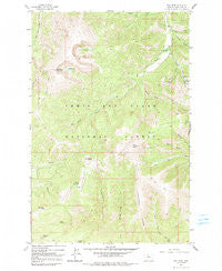
~ Yogo Peak MT topo map, 1:24000 scale, 7.5 X 7.5 Minute, Historical, 1961, updated 1991
Yogo Peak, Montana, USGS topographic map dated 1961.
Includes geographic coordinates (latitude and longitude). This topographic map is suitable for hiking, camping, and exploring, or framing it as a wall map.
Printed on-demand using high resolution imagery, on heavy weight and acid free paper, or alternatively on a variety of synthetic materials.
Topos available on paper, Waterproof, Poly, or Tyvek. Usually shipping rolled, unless combined with other folded maps in one order.
- Product Number: USGS-5400586
- Free digital map download (high-resolution, GeoPDF): Yogo Peak, Montana (file size: 16 MB)
- Map Size: please refer to the dimensions of the GeoPDF map above
- Weight (paper map): ca. 55 grams
- Map Type: POD USGS Topographic Map
- Map Series: HTMC
- Map Verison: Historical
- Cell ID: 50114
- Scan ID: 267749
- Imprint Year: 1991
- Woodland Tint: Yes
- Aerial Photo Year: 1958
- Field Check Year: 1961
- Datum: NAD27
- Map Projection: Polyconic
- Map published by United States Geological Survey
- Map Language: English
- Scanner Resolution: 600 dpi
- Map Cell Name: Yogo Peak
- Grid size: 7.5 X 7.5 Minute
- Date on map: 1961
- Map Scale: 1:24000
- Geographical region: Montana, United States
Neighboring Maps:
All neighboring USGS topo maps are available for sale online at a variety of scales.
Spatial coverage:
Topo map Yogo Peak, Montana, covers the geographical area associated the following places:
- Silver Gulch - Tepee Butte - Prospect Ridge - Big Baldy Mountain - Rolfe Gulch - NW SE Section 10 Mine - Snow Creek - West Fork Stiner Creek - Rhoda Lake - Cabin Mountain - SW SW Section 3 Mine - Gravel Gulch - Lead Gulch - NE SE Section 36 Mine - Appraisal Creek - Tucken Gulch - Hell Creek - Slide Rock Point - Lake Elva - Lyons Gulch - Coyote Peak - NW NE Section 31 Mine - Twin Lakes - Dry Wolf Campground - East Fork Stiner Creek - Iron Gulch - Flat Gulch - Big Deer Point - NW NE Section 2 Mine - Yogo Peak - SE SW Section 31 Mine
- Map Area ID: AREA4746.875-110.625-110.5
- Northwest corner Lat/Long code: USGSNW47-110.625
- Northeast corner Lat/Long code: USGSNE47-110.5
- Southwest corner Lat/Long code: USGSSW46.875-110.625
- Southeast corner Lat/Long code: USGSSE46.875-110.5
- Northern map edge Latitude: 47
- Southern map edge Latitude: 46.875
- Western map edge Longitude: -110.625
- Eastern map edge Longitude: -110.5


