
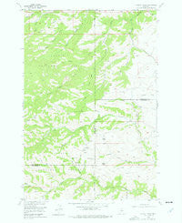
~ Wildcat Draw MT topo map, 1:24000 scale, 7.5 X 7.5 Minute, Historical, 1955, updated 1977
Wildcat Draw, Montana, USGS topographic map dated 1955.
Includes geographic coordinates (latitude and longitude). This topographic map is suitable for hiking, camping, and exploring, or framing it as a wall map.
Printed on-demand using high resolution imagery, on heavy weight and acid free paper, or alternatively on a variety of synthetic materials.
Topos available on paper, Waterproof, Poly, or Tyvek. Usually shipping rolled, unless combined with other folded maps in one order.
- Product Number: USGS-5400354
- Free digital map download (high-resolution, GeoPDF): Wildcat Draw, Montana (file size: 11 MB)
- Map Size: please refer to the dimensions of the GeoPDF map above
- Weight (paper map): ca. 55 grams
- Map Type: POD USGS Topographic Map
- Map Series: HTMC
- Map Verison: Historical
- Cell ID: 49044
- Scan ID: 267622
- Imprint Year: 1977
- Woodland Tint: Yes
- Aerial Photo Year: 1951
- Field Check Year: 1955
- Datum: NAD27
- Map Projection: Polyconic
- Map published by United States Geological Survey
- Map Language: English
- Scanner Resolution: 600 dpi
- Map Cell Name: Wildcat Draw
- Grid size: 7.5 X 7.5 Minute
- Date on map: 1955
- Map Scale: 1:24000
- Geographical region: Montana, United States
Neighboring Maps:
All neighboring USGS topo maps are available for sale online at a variety of scales.
Spatial coverage:
Topo map Wildcat Draw, Montana, covers the geographical area associated the following places:
- Trail Draw - Wildcat Spring Number Two - Blind Bridger Creek - West Trail Draw Spring - White Draw - Porcupine Spring - Jims Gulch - Long Draw - Wildcat Draw - Winge Draw - North Derby Gulch - Oliver Draw - Lundy Draw - 03S16E09DACC01 Well - Boundary Draw - Smith Coulee - Mendenhall Draw - White Spring - Yates Cabin - Hookum Cow Cabin - McKinsey Spring - September Morn Spring - McKinsey Draw - Tepee Creek - Carey Gulch - Beartrap Draw - Sawmill Gulch - Dry Draw - Dry Gulch - Tepee Spring - Boundary Draw Spring - West Trail Draw - Derby Ridge - Russel Draw - Wildcat Spring Number One - Clark Gulch
- Map Area ID: AREA45.62545.5-109.875-109.75
- Northwest corner Lat/Long code: USGSNW45.625-109.875
- Northeast corner Lat/Long code: USGSNE45.625-109.75
- Southwest corner Lat/Long code: USGSSW45.5-109.875
- Southeast corner Lat/Long code: USGSSE45.5-109.75
- Northern map edge Latitude: 45.625
- Southern map edge Latitude: 45.5
- Western map edge Longitude: -109.875
- Eastern map edge Longitude: -109.75


