
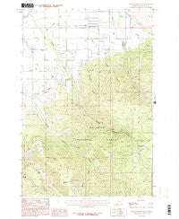
~ Wheeler Mountain MT topo map, 1:24000 scale, 7.5 X 7.5 Minute, Historical, 1987, updated 1987
Wheeler Mountain, Montana, USGS topographic map dated 1987.
Includes geographic coordinates (latitude and longitude). This topographic map is suitable for hiking, camping, and exploring, or framing it as a wall map.
Printed on-demand using high resolution imagery, on heavy weight and acid free paper, or alternatively on a variety of synthetic materials.
Topos available on paper, Waterproof, Poly, or Tyvek. Usually shipping rolled, unless combined with other folded maps in one order.
- Product Number: USGS-5400218
- Free digital map download (high-resolution, GeoPDF): Wheeler Mountain, Montana (file size: 13 MB)
- Map Size: please refer to the dimensions of the GeoPDF map above
- Weight (paper map): ca. 55 grams
- Map Type: POD USGS Topographic Map
- Map Series: HTMC
- Map Verison: Historical
- Cell ID: 48555
- Scan ID: 267543
- Imprint Year: 1987
- Woodland Tint: Yes
- Aerial Photo Year: 1981
- Edit Year: 1987
- Field Check Year: 1984
- Datum: NAD27
- Map Projection: Lambert Conformal Conic
- Provisional map: Yes
- Map published by United States Geological Survey
- Map Language: English
- Scanner Resolution: 600 dpi
- Map Cell Name: Wheeler Mountain
- Grid size: 7.5 X 7.5 Minute
- Date on map: 1987
- Map Scale: 1:24000
- Geographical region: Montana, United States
Neighboring Maps:
All neighboring USGS topo maps are available for sale online at a variety of scales.
Spatial coverage:
Topo map Wheeler Mountain, Montana, covers the geographical area associated the following places:
- 03S05E15DCCA01 Well - 02S05E35DCDC01 Well - 02S05E36BACD01 Well - 03S05E04AB__01 Well - Langohr Springs Campground - 03S06E06DD__02 Well - Leverich School (historical) - Wheeler Mountain - 03S06E06BA__01 Spring - 03S05E21BBBA01 Well - 02S06E32CB__02 Well - 03S05E04BA__01 Well - 03S06E05CBAA01 Well - 02S06E31AD__01 Well - Sunshine Mine - Mystic Lake Ditch - 03S05E03BB__01 Well - 03S05E03AB__01 Well - Leverich Creek - 02S05E34CD__01 Well - 03S05E10CCCB01 Well - Anderson School - 03S05E03DA__01 Well - Dry Gulch - Abbot Recreation Site - 03S05E11DDC_01 Spring - Hodgman Canyon - 03S05E01BA__01 Well - 03S05E10DB__01 Well - 03S05E04AAAD01 Well - 02S05E33DB__01 Well - 03S05E11DDB_01 Spring - 03S05E09AA__01 Well - Wheeler Gulch - 02S05E33DB__02 Well - 03S05E01DC__01 Well - 03S05E04CD__01 Spring - 03S05E10BA__01 Well - 03S05E11BC__01 Well - Moser Creek - 02S05E36DD__01 Well - 03S05E02AD__01 Well - 03S05E21BBA_01 Well - Middle Creek Association Ditch - 03S05E01AC__01 Well - Langohr Springs - 02S05E35DD__02 Well - 03S06E06DD__01 Well - Middle Creek Ditch - 03S05E21BD__01 Well - Hyalite Station - Haggerty Airport - Nichols Creek - 03S05E10BB__01 Well - Sourdough Creek Fishing Access Site - 03S05E02CD__01 Well - 03S05E16AA__01 Well - Hyalite Canyon - 03S06E05BB__01 Well - 03S05E02DA__01 Well - 02S05E36BADD01 Well - 03S05E21BD__02 Spring - Sourdough Rural Fire District Station 2 - 03S05E15CA__01 Spring - 02S05E35CB__01 Well - 03S06E06DA__01 Well - 03S06E06AC__01 Well - 03S05E21AB__01 Well - KBOZ-AM (Bozeman) - 03S05E21BBD_01 Well - 02S06E31DB__01 Well - 02S05E33CB__01 Well - 03S05E11DA__01 Spring - 03S05E11DABD01 Well - West Gallatin Canal - 03S05E11DAAC01 Well - 03S05E12CB__01 Spring - 03S05E09DA__01 Well - Buckskin Creek - 02S05E35DD__01 Well
- Map Area ID: AREA45.62545.5-111.125-111
- Northwest corner Lat/Long code: USGSNW45.625-111.125
- Northeast corner Lat/Long code: USGSNE45.625-111
- Southwest corner Lat/Long code: USGSSW45.5-111.125
- Southeast corner Lat/Long code: USGSSE45.5-111
- Northern map edge Latitude: 45.625
- Southern map edge Latitude: 45.5
- Western map edge Longitude: -111.125
- Eastern map edge Longitude: -111


