
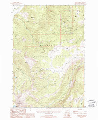
~ Vipond Park MT topo map, 1:24000 scale, 7.5 X 7.5 Minute, Historical, 1988, updated 1988
Vipond Park, Montana, USGS topographic map dated 1988.
Includes geographic coordinates (latitude and longitude). This topographic map is suitable for hiking, camping, and exploring, or framing it as a wall map.
Printed on-demand using high resolution imagery, on heavy weight and acid free paper, or alternatively on a variety of synthetic materials.
Topos available on paper, Waterproof, Poly, or Tyvek. Usually shipping rolled, unless combined with other folded maps in one order.
- Product Number: USGS-5399980
- Free digital map download (high-resolution, GeoPDF): Vipond Park, Montana (file size: 14 MB)
- Map Size: please refer to the dimensions of the GeoPDF map above
- Weight (paper map): ca. 55 grams
- Map Type: POD USGS Topographic Map
- Map Series: HTMC
- Map Verison: Historical
- Cell ID: 46984
- Scan ID: 267402
- Imprint Year: 1988
- Woodland Tint: Yes
- Aerial Photo Year: 1984
- Edit Year: 1988
- Field Check Year: 1986
- Datum: NAD27
- Map Projection: Lambert Conformal Conic
- Provisional map: Yes
- Map published by United States Geological Survey
- Map Language: English
- Scanner Resolution: 600 dpi
- Map Cell Name: Vipond Park
- Grid size: 7.5 X 7.5 Minute
- Date on map: 1988
- Map Scale: 1:24000
- Geographical region: Montana, United States
Neighboring Maps:
All neighboring USGS topo maps are available for sale online at a variety of scales.
Spatial coverage:
Topo map Vipond Park, Montana, covers the geographical area associated the following places:
- Log Cabin Mine - Burnt Pine Post Office (historical) - Canyon Creek Campground - West Lone Pine Mine - Vipond Park - Gray Jockey Mine - Mewonitoc Mine - Marmot Mine - Vega Mine - Queens Gulch - Old Faithful Mine - Daisy Vein Mine - Monte Cristo Mine - Buffalo Head Gulch - Bobs Lake - Queen of the Hills Mine - Quartz Hill (historical) - Gray Jockey Mine - Log Cabin Lode - Tuxedo Mine - SW NE Section 3 Mine - Quartz Hill - Monte Cristo Mine - Black Lion Mountain - Polaris Mine - Blue Bell Mine - Vipond Post Office (historical) - Vipond (historical) - Canyon Creek Camp - Ponsonby Peak - Cannivan Gulch - Gray Jockey Peak - Queen of the Hills Mine - Yanks Pasture - Knoby Spring - Greenwood (historical) - Lone Pine (historical) - Knoby Mine - Boner Knob - Lone Pine Mine - Sheep Mountain - Echo Gulch - Great Western Mine - Mammoth Gulch - Black Lion Lake - Canyon Creek Guard Station - Knoby Park
- Map Area ID: AREA45.7545.625-113-112.875
- Northwest corner Lat/Long code: USGSNW45.75-113
- Northeast corner Lat/Long code: USGSNE45.75-112.875
- Southwest corner Lat/Long code: USGSSW45.625-113
- Southeast corner Lat/Long code: USGSSE45.625-112.875
- Northern map edge Latitude: 45.75
- Southern map edge Latitude: 45.625
- Western map edge Longitude: -113
- Eastern map edge Longitude: -112.875


