
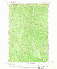
~ Vermilion Peak MT topo map, 1:24000 scale, 7.5 X 7.5 Minute, Historical, 1966, updated 1970
Vermilion Peak, Montana, USGS topographic map dated 1966.
Includes geographic coordinates (latitude and longitude). This topographic map is suitable for hiking, camping, and exploring, or framing it as a wall map.
Printed on-demand using high resolution imagery, on heavy weight and acid free paper, or alternatively on a variety of synthetic materials.
Topos available on paper, Waterproof, Poly, or Tyvek. Usually shipping rolled, unless combined with other folded maps in one order.
- Product Number: USGS-5399960
- Free digital map download (high-resolution, GeoPDF): Vermilion Peak, Montana (file size: 14 MB)
- Map Size: please refer to the dimensions of the GeoPDF map above
- Weight (paper map): ca. 55 grams
- Map Type: POD USGS Topographic Map
- Map Series: HTMC
- Map Verison: Historical
- Cell ID: 46786
- Scan ID: 267391
- Imprint Year: 1970
- Woodland Tint: Yes
- Visual Version Number: 1
- Aerial Photo Year: 1965
- Field Check Year: 1966
- Datum: NAD27
- Map Projection: Polyconic
- Map published by United States Geological Survey
- Map Language: English
- Scanner Resolution: 600 dpi
- Map Cell Name: Vermilion Peak
- Grid size: 7.5 X 7.5 Minute
- Date on map: 1966
- Map Scale: 1:24000
- Geographical region: Montana, United States
Neighboring Maps:
All neighboring USGS topo maps are available for sale online at a variety of scales.
Spatial coverage:
Topo map Vermilion Peak, Montana, covers the geographical area associated the following places:
- Bear Creek Trail - Willow Creek - Willow Creek Recreation Site - Stony Lake - Miller Creek Trail - Snow Gulch - Toboggan Creek - Sylvan Lake - Ice Creek - Vermilion Pass - Willow Creek Campground - Moose Gulch - Freezeout Creek - Control Creek - Terrace Lake - Frosty Creek - B Peak - Image Lake - Rush Lake - Vermilion Peak - Hunters Draw - Slide Rock Mountain - Miller Creek - Cold Creek - Queer Creek - Slide Rock Mountain Trail - Happy Gulch - Graves Peak - Chilly Creek - Charred Creek
- Map Area ID: AREA47.87547.75-115.375-115.25
- Northwest corner Lat/Long code: USGSNW47.875-115.375
- Northeast corner Lat/Long code: USGSNE47.875-115.25
- Southwest corner Lat/Long code: USGSSW47.75-115.375
- Southeast corner Lat/Long code: USGSSE47.75-115.25
- Northern map edge Latitude: 47.875
- Southern map edge Latitude: 47.75
- Western map edge Longitude: -115.375
- Eastern map edge Longitude: -115.25


