
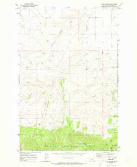
~ Twin Sisters MT topo map, 1:24000 scale, 7.5 X 7.5 Minute, Historical, 1970, updated 1973
Twin Sisters, Montana, USGS topographic map dated 1970.
Includes geographic coordinates (latitude and longitude). This topographic map is suitable for hiking, camping, and exploring, or framing it as a wall map.
Printed on-demand using high resolution imagery, on heavy weight and acid free paper, or alternatively on a variety of synthetic materials.
Topos available on paper, Waterproof, Poly, or Tyvek. Usually shipping rolled, unless combined with other folded maps in one order.
- Product Number: USGS-5399836
- Free digital map download (high-resolution, GeoPDF): Twin Sisters, Montana (file size: 10 MB)
- Map Size: please refer to the dimensions of the GeoPDF map above
- Weight (paper map): ca. 55 grams
- Map Type: POD USGS Topographic Map
- Map Series: HTMC
- Map Verison: Historical
- Cell ID: 46144
- Scan ID: 267322
- Imprint Year: 1973
- Woodland Tint: Yes
- Aerial Photo Year: 1968
- Field Check Year: 1970
- Datum: NAD27
- Map Projection: Polyconic
- Map published by United States Geological Survey
- Map Language: English
- Scanner Resolution: 600 dpi
- Map Cell Name: Twin Sisters
- Grid size: 7.5 X 7.5 Minute
- Date on map: 1970
- Map Scale: 1:24000
- Geographical region: Montana, United States
Neighboring Maps:
All neighboring USGS topo maps are available for sale online at a variety of scales.
Spatial coverage:
Topo map Twin Sisters, Montana, covers the geographical area associated the following places:
- 12N13E21AD__01 Spring - 12N13E08AA__01 Spring - 13N13E23CD__01 Spring - 13N13E19AC__01 Spring - 12N13E22AB__01 Spring - 12N13E12DA__01 Well - 12N13E01CA__02 Spring - 12N13E20CB__01 Spring - 12N13E10AB__01 Spring - Basin Creek - 12N13E15DB__01 Spring - 12N14E07AC__01 Spring - 13N13E28BA__01 Spring - 13N13E23DB__01 Spring - 12N13E10BD__01 Spring - 12N13E22CD__02 Spring - 12N14E18AC__01 Spring - 12N13E22AC__01 Spring - 12N14E06AB__01 Well - 12N13E24AB__01 Well - 12N13E01CA__01 Spring - 13N13E25DA__01 Well - 12N14E30CD__01 Spring - 12N14E07CDDA01 Well - 13N13E30DD__01 Well - 12N13E26BA__02 Spring - 12N13E01DC__03 Spring - 12N14E06BC__01 Spring - 13N14E31BB__01 Well - East Antelope Creek - 13N13E36CC__01 Well - 12N13E24AB__02 Spring - 12N13E24AB__03 Well - 12N13E21DD__01 Spring - 12N14E07BD__01 Spring - 12N14E07BAAB01 Well - 12N13E16DA__01 Spring - 13N13E35BA__01 Spring - 13N13E28DB__01 Spring - 13N13E27AB__01 Spring - 12N13E14AA__01 Spring - 12N13E10AABB01 Well - 12N13E22CA__01 Spring - 13N13E21CC__01 Well - 13N13E30DD__02 Well - 12N13E26BA__01 Spring - 12N13E20DB__01 Spring - 12N14E19BA__01 Spring - 13N13E25AA__01 Well - Twin Sisters - 12N13E08BB__01 Spring - 12N13E10BC__01 Spring - 12N13E21DB__01 Spring - 12N13E22AB__02 Spring - 12N13E21CA__01 Spring - 12N13E22BA__01 Spring - 12N13E21DD__02 Spring - 12N13E20DA__01 Spring - 12N13E02AA__01 Spring - 12N13E01DC__02 Well - 12N13E22CD__01 Spring - 13N13E26AC__01 Spring - 13N13E22AC__01 Spring - 12N13E01DC__01 Well - 12N13E02BA__01 Well - 13N13E26AB__01 Spring
- Map Area ID: AREA46.87546.75-110.125-110
- Northwest corner Lat/Long code: USGSNW46.875-110.125
- Northeast corner Lat/Long code: USGSNE46.875-110
- Southwest corner Lat/Long code: USGSSW46.75-110.125
- Southeast corner Lat/Long code: USGSSE46.75-110
- Northern map edge Latitude: 46.875
- Southern map edge Latitude: 46.75
- Western map edge Longitude: -110.125
- Eastern map edge Longitude: -110


