
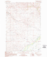
~ Twin Bridges SW MT topo map, 1:24000 scale, 7.5 X 7.5 Minute, Historical, 1989, updated 1989
Twin Bridges SW, Montana, USGS topographic map dated 1989.
Includes geographic coordinates (latitude and longitude). This topographic map is suitable for hiking, camping, and exploring, or framing it as a wall map.
Printed on-demand using high resolution imagery, on heavy weight and acid free paper, or alternatively on a variety of synthetic materials.
Topos available on paper, Waterproof, Poly, or Tyvek. Usually shipping rolled, unless combined with other folded maps in one order.
- Product Number: USGS-5399818
- Free digital map download (high-resolution, GeoPDF): Twin Bridges SW, Montana (file size: 10 MB)
- Map Size: please refer to the dimensions of the GeoPDF map above
- Weight (paper map): ca. 55 grams
- Map Type: POD USGS Topographic Map
- Map Series: HTMC
- Map Verison: Historical
- Cell ID: 46084
- Scan ID: 267312
- Imprint Year: 1989
- Woodland Tint: Yes
- Aerial Photo Year: 1985
- Edit Year: 1989
- Field Check Year: 1987
- Datum: NAD27
- Map Projection: Lambert Conformal Conic
- Provisional map: Yes
- Map published by United States Geological Survey
- Map Language: English
- Scanner Resolution: 600 dpi
- Map Cell Name: Twin Bridges SW
- Grid size: 7.5 X 7.5 Minute
- Date on map: 1989
- Map Scale: 1:24000
- Geographical region: Montana, United States
Neighboring Maps:
All neighboring USGS topo maps are available for sale online at a variety of scales.
Spatial coverage:
Topo map Twin Bridges SW, Montana, covers the geographical area associated the following places:
- Nez Perce Creek - SW Section 9 Mine - NE Section 4 Mine - NW Section 5 Mine - Hermit Mine - Alaska Mine - Rock Spring Ranch - Monitor Mine - Full House Mine - NW Section 33 Mine - Never Fail Mine - Crystal Mine - Anything Mine - End Mine - SW Section 3 Mine - Ellen Marshall Mine - Muriers (historical) - 03S07W05DCDB01 Spring - Eclipse Mine - Pageville Post Office (historical) - Idler Mine - NW Section 26 Mine - Pageville School (historical) - NW Section 15 Mine - Sunbeam/ID Number 2 Mine - Pennington Bridge Fishing Access Site - Elizabeth Mine
- Map Area ID: AREA45.62545.5-112.5-112.375
- Northwest corner Lat/Long code: USGSNW45.625-112.5
- Northeast corner Lat/Long code: USGSNE45.625-112.375
- Southwest corner Lat/Long code: USGSSW45.5-112.5
- Southeast corner Lat/Long code: USGSSE45.5-112.375
- Northern map edge Latitude: 45.625
- Southern map edge Latitude: 45.5
- Western map edge Longitude: -112.5
- Eastern map edge Longitude: -112.375


