
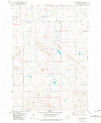
~ Tip Top Butte MT topo map, 1:24000 scale, 7.5 X 7.5 Minute, Historical, 1982, updated 1982
Tip Top Butte, Montana, USGS topographic map dated 1982.
Includes geographic coordinates (latitude and longitude). This topographic map is suitable for hiking, camping, and exploring, or framing it as a wall map.
Printed on-demand using high resolution imagery, on heavy weight and acid free paper, or alternatively on a variety of synthetic materials.
Topos available on paper, Waterproof, Poly, or Tyvek. Usually shipping rolled, unless combined with other folded maps in one order.
- Product Number: USGS-5399672
- Free digital map download (high-resolution, GeoPDF): Tip Top Butte, Montana (file size: 9 MB)
- Map Size: please refer to the dimensions of the GeoPDF map above
- Weight (paper map): ca. 55 grams
- Map Type: POD USGS Topographic Map
- Map Series: HTMC
- Map Verison: Historical
- Cell ID: 45221
- Scan ID: 267219
- Imprint Year: 1982
- Woodland Tint: Yes
- Aerial Photo Year: 1973
- Edit Year: 1982
- Field Check Year: 1975
- Datum: NAD27
- Map Projection: Lambert Conformal Conic
- Map published by United States Geological Survey
- Map Language: English
- Scanner Resolution: 600 dpi
- Map Cell Name: Tip Top Butte
- Grid size: 7.5 X 7.5 Minute
- Date on map: 1982
- Map Scale: 1:24000
- Geographical region: Montana, United States
Neighboring Maps:
All neighboring USGS topo maps are available for sale online at a variety of scales.
Spatial coverage:
Topo map Tip Top Butte, Montana, covers the geographical area associated the following places:
- Cow Creek - Climax Post Office (historical) - Lost Calf Detention Dam - Flattops - Traucks Dam - Clear Fork - Wolf Point - East Fork T L Creek - Climax School (historical) - West Fork T L Creek - Burch Dam - Helen B Dam - 05S57E31AB__01 Well - Helen B Dent Dam - Dead Horse Point - Twin Buttes - Tip Top Butte - Square Butte Reservoir Dam - Hay Creek - T L Creek
- Map Area ID: AREA45.37545.25-104.75-104.625
- Northwest corner Lat/Long code: USGSNW45.375-104.75
- Northeast corner Lat/Long code: USGSNE45.375-104.625
- Southwest corner Lat/Long code: USGSSW45.25-104.75
- Southeast corner Lat/Long code: USGSSE45.25-104.625
- Northern map edge Latitude: 45.375
- Southern map edge Latitude: 45.25
- Western map edge Longitude: -104.75
- Eastern map edge Longitude: -104.625


