
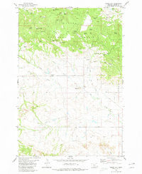
~ Timber Hill MT topo map, 1:24000 scale, 7.5 X 7.5 Minute, Historical, 1980, updated 1980
Timber Hill, Montana, USGS topographic map dated 1980.
Includes geographic coordinates (latitude and longitude). This topographic map is suitable for hiking, camping, and exploring, or framing it as a wall map.
Printed on-demand using high resolution imagery, on heavy weight and acid free paper, or alternatively on a variety of synthetic materials.
Topos available on paper, Waterproof, Poly, or Tyvek. Usually shipping rolled, unless combined with other folded maps in one order.
- Product Number: USGS-5399658
- Free digital map download (high-resolution, GeoPDF): Timber Hill, Montana (file size: 11 MB)
- Map Size: please refer to the dimensions of the GeoPDF map above
- Weight (paper map): ca. 55 grams
- Map Type: POD USGS Topographic Map
- Map Series: HTMC
- Map Verison: Historical
- Cell ID: 45143
- Scan ID: 267211
- Imprint Year: 1980
- Woodland Tint: Yes
- Aerial Photo Year: 1972
- Edit Year: 1980
- Field Check Year: 1974
- Datum: NAD27
- Map Projection: Lambert Conformal Conic
- Map published by United States Geological Survey
- Map Language: English
- Scanner Resolution: 600 dpi
- Map Cell Name: Timber Hill
- Grid size: 7.5 X 7.5 Minute
- Date on map: 1980
- Map Scale: 1:24000
- Geographical region: Montana, United States
Neighboring Maps:
All neighboring USGS topo maps are available for sale online at a variety of scales.
Spatial coverage:
Topo map Timber Hill, Montana, covers the geographical area associated the following places:
- Tie Creek School (historical) - Curley Spring - Ballinger Spring - Cheesman Draw - 03S61E24CDBD01 Well - Picnic Spring - Big Tree Spring - North Tie Creek - Pioneer Cemetery - Lost Farm Spring Number 1 - Rema School (historical) - Sawmill Spring - Lost Farm Spring Number 2 - 04S61E03CACC01 Well - Big Tree Draw - Weller Draw - Gergen Spring - Gergen Reservoir - Timber Hill - Padden Number 2 Dam - German Number 2 Dam - Blacktail Draw - Gergen Creek - Rema Post Office (historical) - McClary Ranger Station - Brewer Reservoir - Pot Hole Reservoir - Icebox Spring - Double F Spring Number 2 - Belltower Divide - Maverick Spring Number 1 - Sawdust Spring - Double F Spring Number 1 - Maverick Spring Number 2 - McClary Spring Number 1 - V Bar M Spring - White Rock Spring - Big Noise Spring
- Map Area ID: AREA45.62545.5-104.25-104.125
- Northwest corner Lat/Long code: USGSNW45.625-104.25
- Northeast corner Lat/Long code: USGSNE45.625-104.125
- Southwest corner Lat/Long code: USGSSW45.5-104.25
- Southeast corner Lat/Long code: USGSSE45.5-104.125
- Northern map edge Latitude: 45.625
- Southern map edge Latitude: 45.5
- Western map edge Longitude: -104.25
- Eastern map edge Longitude: -104.125


