
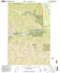
~ Table Top Mountain MT topo map, 1:24000 scale, 7.5 X 7.5 Minute, Historical, 1999, updated 2003
Table Top Mountain, Montana, USGS topographic map dated 1999.
Includes geographic coordinates (latitude and longitude). This topographic map is suitable for hiking, camping, and exploring, or framing it as a wall map.
Printed on-demand using high resolution imagery, on heavy weight and acid free paper, or alternatively on a variety of synthetic materials.
Topos available on paper, Waterproof, Poly, or Tyvek. Usually shipping rolled, unless combined with other folded maps in one order.
- Product Number: USGS-5399448
- Free digital map download (high-resolution, GeoPDF): Table Top Mountain, Montana (file size: 19 MB)
- Map Size: please refer to the dimensions of the GeoPDF map above
- Weight (paper map): ca. 55 grams
- Map Type: POD USGS Topographic Map
- Map Series: HTMC
- Map Verison: Historical
- Cell ID: 44159
- Scan ID: 267096
- Imprint Year: 2003
- Woodland Tint: Yes
- Aerial Photo Year: 1995
- Edit Year: 1999
- Survey Year: 1980
- Datum: NAD27
- Map Projection: Lambert Conformal Conic
- Map published by United States Geological Survey
- Map published by United States Forest Service
- Map Language: English
- Scanner Resolution: 600 dpi
- Map Cell Name: Table Top Mountain
- Grid size: 7.5 X 7.5 Minute
- Date on map: 1999
- Map Scale: 1:24000
- Geographical region: Montana, United States
Neighboring Maps:
All neighboring USGS topo maps are available for sale online at a variety of scales.
Spatial coverage:
Topo map Table Top Mountain, Montana, covers the geographical area associated the following places:
- Joan Creek - Shorty Gulch - Flatiron Ridge - South Fork Wilkes Creek - Clark Fork River Bridge - 21N30W14AAAD01 Well - Table Top Mountain - Birdland Bay RV Resort - Pinehurst (historical) - Table Top Gulch - Clear Creek - Hill Seven - Wilkes Creek - Valentine Gulch - Brush Gulch - Thompson Falls State Recreation Area - Thompson Falls Campground - Daisy Creek Pass - Thompson Falls State Park Campground - Foster Gulch - Coyote Gulch
- Map Area ID: AREA47.62547.5-115.5-115.375
- Northwest corner Lat/Long code: USGSNW47.625-115.5
- Northeast corner Lat/Long code: USGSNE47.625-115.375
- Southwest corner Lat/Long code: USGSSW47.5-115.5
- Southeast corner Lat/Long code: USGSSE47.5-115.375
- Northern map edge Latitude: 47.625
- Southern map edge Latitude: 47.5
- Western map edge Longitude: -115.5
- Eastern map edge Longitude: -115.375


