
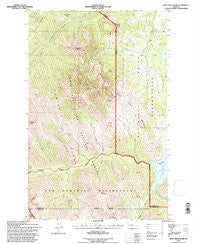
~ Swift Reservoir MT topo map, 1:24000 scale, 7.5 X 7.5 Minute, Historical, 1995, updated 1997
Swift Reservoir, Montana, USGS topographic map dated 1995.
Includes geographic coordinates (latitude and longitude). This topographic map is suitable for hiking, camping, and exploring, or framing it as a wall map.
Printed on-demand using high resolution imagery, on heavy weight and acid free paper, or alternatively on a variety of synthetic materials.
Topos available on paper, Waterproof, Poly, or Tyvek. Usually shipping rolled, unless combined with other folded maps in one order.
- Product Number: USGS-5399410
- Free digital map download (high-resolution, GeoPDF): Swift Reservoir, Montana (file size: 17 MB)
- Map Size: please refer to the dimensions of the GeoPDF map above
- Weight (paper map): ca. 55 grams
- Map Type: POD USGS Topographic Map
- Map Series: HTMC
- Map Verison: Historical
- Cell ID: 44039
- Scan ID: 267077
- Imprint Year: 1997
- Woodland Tint: Yes
- Aerial Photo Year: 1995
- Field Check Year: 1995
- Datum: NAD27
- Map Projection: Lambert Conformal Conic
- Map published by United States Geological Survey
- Map published by United States Forest Service
- Map Language: English
- Scanner Resolution: 600 dpi
- Map Cell Name: Swift Reservoir
- Grid size: 7.5 X 7.5 Minute
- Date on map: 1995
- Map Scale: 1:24000
- Geographical region: Montana, United States
Neighboring Maps:
All neighboring USGS topo maps are available for sale online at a variety of scales.
Spatial coverage:
Topo map Swift Reservoir, Montana, covers the geographical area associated the following places:
- Feather Woman Mountain - Blind Creek - Mount Sentinel - Mount Poia - Killem Horse Creek - Lookout Ridge - Hungry Man Creek - Heart Butte - Swift Dike - North Fork Birch Creek - Steep Creek - Small Creek - Major Steele Backbone - South Fork Birch Creek - 28N10W22DDCA01 Spring - Mount Richmond - Phillips Creek - Swift Reservoir - Haywood Creek
- Map Area ID: AREA48.2548.125-113-112.875
- Northwest corner Lat/Long code: USGSNW48.25-113
- Northeast corner Lat/Long code: USGSNE48.25-112.875
- Southwest corner Lat/Long code: USGSSW48.125-113
- Southeast corner Lat/Long code: USGSSE48.125-112.875
- Northern map edge Latitude: 48.25
- Southern map edge Latitude: 48.125
- Western map edge Longitude: -113
- Eastern map edge Longitude: -112.875


