
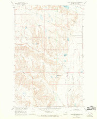
~ Stratton Reservoir MT topo map, 1:24000 scale, 7.5 X 7.5 Minute, Historical, 1965, updated 1969
Stratton Reservoir, Montana, USGS topographic map dated 1965.
Includes geographic coordinates (latitude and longitude). This topographic map is suitable for hiking, camping, and exploring, or framing it as a wall map.
Printed on-demand using high resolution imagery, on heavy weight and acid free paper, or alternatively on a variety of synthetic materials.
Topos available on paper, Waterproof, Poly, or Tyvek. Usually shipping rolled, unless combined with other folded maps in one order.
- Product Number: USGS-5399256
- Free digital map download (high-resolution, GeoPDF): Stratton Reservoir, Montana (file size: 11 MB)
- Map Size: please refer to the dimensions of the GeoPDF map above
- Weight (paper map): ca. 55 grams
- Map Type: POD USGS Topographic Map
- Map Series: HTMC
- Map Verison: Historical
- Cell ID: 71738
- Scan ID: 266986
- Imprint Year: 1969
- Aerial Photo Year: 1965
- Field Check Year: 1965
- Datum: NAD27
- Map Projection: Polyconic
- Map published by United States Geological Survey
- Map Language: English
- Scanner Resolution: 600 dpi
- Map Cell Name: Stratton Reservoir
- Grid size: 7.5 X 7.5 Minute
- Date on map: 1965
- Map Scale: 1:24000
- Geographical region: Montana, United States
Neighboring Maps:
All neighboring USGS topo maps are available for sale online at a variety of scales.
Spatial coverage:
Topo map Stratton Reservoir, Montana, covers the geographical area associated the following places:
- King Reservoir - Number Twenty Reservoir Dam - McNeil Reservoir - Salene Reservoir - 23N31E05CA__01 Well - Second Creek - King Reservoir Dam - Koss Number 3 Dam - Prairie Union School (historical) - 24N31E30AB__01 Well - First Creek Community Center - Wilson Reservoir - Dry Lake - Skull Reservoir - 24N31E29DAC_01 Well - Number Twenty Reservoir - Tank Coulee - R Ereaux Number 1 Dam - Stratton Reservoir - Barnard Dam - First Creek - 23N31E05AA__01 Well
- Map Area ID: AREA47.87547.75-107.875-107.75
- Northwest corner Lat/Long code: USGSNW47.875-107.875
- Northeast corner Lat/Long code: USGSNE47.875-107.75
- Southwest corner Lat/Long code: USGSSW47.75-107.875
- Southeast corner Lat/Long code: USGSSE47.75-107.75
- Northern map edge Latitude: 47.875
- Southern map edge Latitude: 47.75
- Western map edge Longitude: -107.875
- Eastern map edge Longitude: -107.75


