
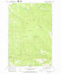
~ Stemple Pass MT topo map, 1:24000 scale, 7.5 X 7.5 Minute, Historical, 1968, updated 1979
Stemple Pass, Montana, USGS topographic map dated 1968.
Includes geographic coordinates (latitude and longitude). This topographic map is suitable for hiking, camping, and exploring, or framing it as a wall map.
Printed on-demand using high resolution imagery, on heavy weight and acid free paper, or alternatively on a variety of synthetic materials.
Topos available on paper, Waterproof, Poly, or Tyvek. Usually shipping rolled, unless combined with other folded maps in one order.
- Product Number: USGS-5399184
- Free digital map download (high-resolution, GeoPDF): Stemple Pass, Montana (file size: 12 MB)
- Map Size: please refer to the dimensions of the GeoPDF map above
- Weight (paper map): ca. 55 grams
- Map Type: POD USGS Topographic Map
- Map Series: HTMC
- Map Verison: Historical
- Cell ID: 43088
- Scan ID: 266941
- Imprint Year: 1979
- Woodland Tint: Yes
- Aerial Photo Year: 1967
- Field Check Year: 1968
- Datum: NAD27
- Map Projection: Polyconic
- Map published by United States Geological Survey
- Map Language: English
- Scanner Resolution: 600 dpi
- Map Cell Name: Stemple Pass
- Grid size: 7.5 X 7.5 Minute
- Date on map: 1968
- Map Scale: 1:24000
- Geographical region: Montana, United States
Neighboring Maps:
All neighboring USGS topo maps are available for sale online at a variety of scales.
Spatial coverage:
Topo map Stemple Pass, Montana, covers the geographical area associated the following places:
- Rooster Bill Creek - Bear Gulch - Gould Post Office (historical) - Gould Creek - Stemple Creek - SE NE Section 16 Mine - Sandbar Creek - MS 9351 Mine - NE NW Section 13 Mine - Stemple Pass - Stemple Post Office (historical) - Fool Hen Creek - Flesher Pass Trail - Whiskey Gulch - Gold Creek - SE SW Section 10 Mine - Alpha-Omega Mine - Stemple (historical) - Pangewasset Mine - Astor Mine - Horsefly Creek - Page Gulch - Gould (historical) - SW NW Section 15 Mine
- Map Area ID: AREA4746.875-112.5-112.375
- Northwest corner Lat/Long code: USGSNW47-112.5
- Northeast corner Lat/Long code: USGSNE47-112.375
- Southwest corner Lat/Long code: USGSSW46.875-112.5
- Southeast corner Lat/Long code: USGSSE46.875-112.375
- Northern map edge Latitude: 47
- Southern map edge Latitude: 46.875
- Western map edge Longitude: -112.5
- Eastern map edge Longitude: -112.375


