
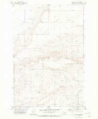
~ Stanford NE MT topo map, 1:24000 scale, 7.5 X 7.5 Minute, Historical, 1978, updated 1979
Stanford NE, Montana, USGS topographic map dated 1978.
Includes geographic coordinates (latitude and longitude). This topographic map is suitable for hiking, camping, and exploring, or framing it as a wall map.
Printed on-demand using high resolution imagery, on heavy weight and acid free paper, or alternatively on a variety of synthetic materials.
Topos available on paper, Waterproof, Poly, or Tyvek. Usually shipping rolled, unless combined with other folded maps in one order.
- Product Number: USGS-5399138
- Free digital map download (high-resolution, GeoPDF): Stanford NE, Montana (file size: 10 MB)
- Map Size: please refer to the dimensions of the GeoPDF map above
- Weight (paper map): ca. 55 grams
- Map Type: POD USGS Topographic Map
- Map Series: HTMC
- Map Verison: Historical
- Cell ID: 42885
- Scan ID: 266918
- Imprint Year: 1979
- Woodland Tint: Yes
- Aerial Photo Year: 1971
- Edit Year: 1978
- Field Check Year: 1973
- Datum: NAD27
- Map Projection: Lambert Conformal Conic
- Map published by United States Geological Survey
- Map Language: English
- Scanner Resolution: 600 dpi
- Map Cell Name: Stanford NE
- Grid size: 7.5 X 7.5 Minute
- Date on map: 1978
- Map Scale: 1:24000
- Geographical region: Montana, United States
Neighboring Maps:
All neighboring USGS topo maps are available for sale online at a variety of scales.
Spatial coverage:
Topo map Stanford NE, Montana, covers the geographical area associated the following places:
- 17N13E26DAA_01 Well - 17N13E32CBB_01 Well - 16N13E14BBB_01 Well - 17N13E36ACB_01 Well - 17N13E25BAB_01 Well - Walker Spring - 16N13E23DDA_01 Well - 17N13E14ABB_02 Well - Coyote Bench - 16N13E18AB__01 Well - 16N14E07BDBB01 Well - 16N13E11DADA01 Well - Spring Creek - 16N13E19AACD01 Well - Coyote Post Office (historical) - Lewis Post Office (historical) - 16N13E19AAC_01 Well - 17N13E30DBD_01 Well - 16N14E07BBDA01 Well - 16N13E15CCAD01 Well - 16N13E01DDBD02 Well - 16N13E05DDD_01 Well - 17N13E26ADAD01 Well - Spring Branch - 17N13E32ACD_01 Well - 16N14E07BDDB01 Well - 16N13E23AAD_01 Well - 16N13E12DDD_01 Spring - 16N13E20CDB_01 Well - 17N13E26CDC_01 Well - 16N14E18BDD_01 Well - 16N13E20DDA_01 Well - Coyote School (historical) - 16N13E15DAC_01 Well - 17N13E14ABB_01 Well - 16N13E15CCC_01 Well
- Map Area ID: AREA47.2547.125-110.125-110
- Northwest corner Lat/Long code: USGSNW47.25-110.125
- Northeast corner Lat/Long code: USGSNE47.25-110
- Southwest corner Lat/Long code: USGSSW47.125-110.125
- Southeast corner Lat/Long code: USGSSE47.125-110
- Northern map edge Latitude: 47.25
- Southern map edge Latitude: 47.125
- Western map edge Longitude: -110.125
- Eastern map edge Longitude: -110


